
Ala Archa National Park rises from river gorge to glacier
Published on 09/23/2026 at 08:49 | Editorial responsibility: Rafael Müller, Editor-in-Chief AD HOC NEWS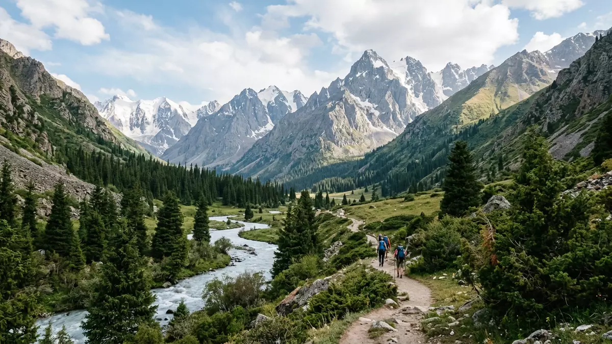
Ala Archa National Park stretches south of Bischkek from a river gorge into the high mountains of Kyrgyzstan. Its visible character is a rapid change of landscape: juniper woodland and flowing water give way to alpine slopes, bare ridges and glaciated summits.
Ala Archa National Park begins with the Ala-Archa River
The park lies in the Kyrgyz Ala-Too range, part of the Tian Shan mountains. The Ala-Archa River runs through the protected valley, with steep slopes rising on both sides and side valleys opening towards higher ground. The lower landscape combines river gravel, conifer woodland, open grass and dark mountain walls.
The name Ala Archa refers to a colourful juniper associated with the mountain slopes. Juniper woodland is a defining feature of the lower valley, where the river corridor provides the clearest introduction to the park’s landscape. Higher ground changes into alpine vegetation, exposed rock and snowfields.
From forested slopes to the high Tian Shan
Ala Archa National Park extends across an elevation range from about 1,500 m (4,921 ft) near the entrance to almost 4,895 m (16,060 ft) at Semenov-Tian-Shansky Peak. The vertical sequence places forest, meadow, rock and glacial terrain within the same protected mountain area. the park’s elevation range reaches from the lower gorge to the main crest.
Several summits rise above 4,500 m (14,764 ft), while glaciers occupy the upper valleys. Korona Peak reaches 4,860 m (15,945 ft), and Free Korea Peak reaches 4,740 m (15,551 ft). These names belong to a landscape of cirques, rock walls and ice rather than a single viewpoint.
A protected mountain landscape established in 1976
Ala Archa National Park was established in 1976. Its protected territory covers roughly 200 square kilometres and includes river valleys, juniper slopes, alpine meadows, glaciers and high peaks. Ala Archa’s protected landscape belongs to northern Kyrgyzstan’s Tian Shan environment.
The park’s character is defined by the relationship between its river and its altitude. The lower valley can be followed through woodland and open mountain terrain, while routes into the Ak-Sai valley lead towards steeper ground and the Ak-Sai glacier icefall. The landscape therefore changes from a broad river corridor to a more enclosed alpine setting.
Visiting Ala Archa National Park: what travellers from Western Europe should know
- Ala Archa National Park lies south of Bischkek in Kyrgyzstan. Road access follows the valley towards the park entrance, and taxis or private vehicles are used for the approach from the capital.
- The lower valley has a riverside route through juniper woodland. Higher walks lead across steeper slopes, loose rock and alpine terrain.
- The Ak-Sai route rises towards the waterfall and glacier scenery. Mountain routes continue into terrain suited to experienced walkers and climbers.
- The official language is Kyrgyz and Russian, and the currency is the Kyrgyzstani som.
- Entry requirements depend on your nationality; UK travellers can check the FCDO travel advice at gov.uk/foreign-travel-advice, Irish travellers the Department of Foreign Affairs at ireland.ie.
Searching for Ala Archa National Park on social platforms
These links open searches for Ala Archa National Park on each platform.Frequently asked questions about Ala Archa National Park
Where is Ala Archa National Park?
Ala Archa National Park is in northern Kyrgyzstan, south of Bischkek, within the Kyrgyz Ala-Too range of the Tian Shan.
What can visitors expect in the park?
The lower valley contains the Ala-Archa River and juniper woodland. Higher routes lead across alpine slopes towards waterfalls, glaciers and rocky summits.
What makes Ala Archa distinctive?
The park combines a river gorge, juniper forest, alpine meadows, glaciers and peaks approaching 4,895 m (16,060 ft) within one protected mountain landscape.


