
Altstadt Bern and its sandstone arcades above the Aare
Published on 09/01/2026 at 17:24 | Editorial responsibility: Rafael Müller, Editor-in-Chief AD HOC NEWS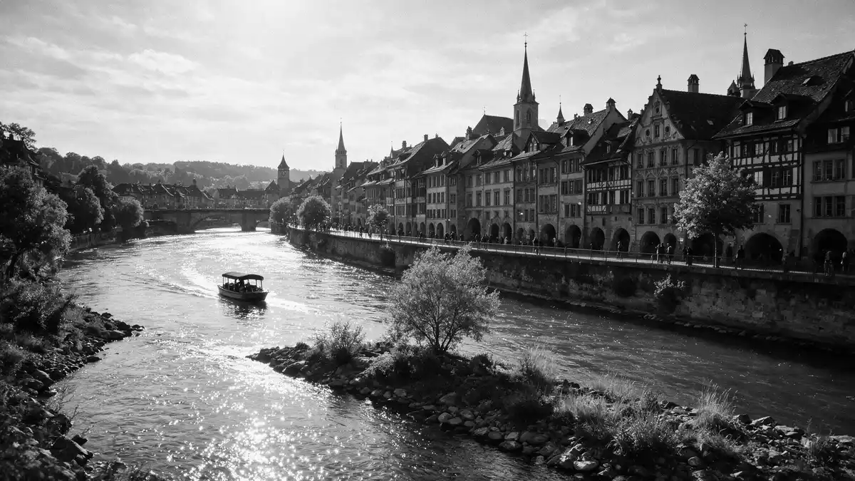
Altstadt Bern, the medieval old town of Bern in Switzerland, rises on a narrow sandstone ridge enclosed by a loop of the Aare River and forms the historic core of the federal capital. Founded in 1191 under Duke Berchtold V of Zähringen, the old city grew over the thirteenth and fourteenth centuries into a compact urban peninsula whose street grid and building volumes remain legible in the streets today.founded in 1191 by Berchtold V of Zähringen Since 1983 the Old City of Bern has been inscribed as a UNESCO World Heritage Site, recognised for the integrity of its medieval townscape and the way it accommodates the functions of a modern national capital.UNESCO World Heritage inscription in 1983
A sandstone city on a river peninsula
The defining experience of Altstadt Bern is the encounter with a whole city built largely from local sandstone, spread along a ridge within the embrace of the Aare. The old town occupies this elongated peninsula, bordered on three sides by the river, which gives the streets a clear axis and makes views of water and steep banks a recurrent presence between the buildings.medieval centre on a hill bordered by the Aare Houses line longitudinal streets that follow the ridge, their façades punctuated by arcades and rows of windows, while transverse lanes drop towards the river and reveal the topography in stages.
Across the façades the pale sandstone creates a unified palette, contrasting with tiled roofs and the painted figures of numerous fountains that stand at junctions and along main streets. Many fountains date from the Renaissance era and carry allegorical statues or heraldic motifs above stone basins, adding vertical accents to otherwise horizontal streets.collection of Renaissance fountains From certain points near the cathedral tower or the Nydegg area, the Aare appears far below, curving around the ridge and separating the old town from the newer quarters beyond.
Zähringer planning and the medieval street grid
Altstadt Bern preserves the layout of a Zähringer foundation city, with three principal longitudinal streets running along the ridge and cross streets linking them in a regular pattern. This Zähringerstadt, as the central neighbourhood is known, originally stretched from Nydegg Castle by the Aare up to the Zytglogge, the clock tower that once marked the western edge of the medieval town.Zähringerstadt central and oldest neighbourhood Later, additional streets such as Brunngasse and Herrengasse were added along the northern and southern edges of the peninsula, completing a grid that still shapes movement through the old town.
Within this planned structure, functions were historically grouped by street. Official buildings clustered around Kreuzgasse, ecclesiastical institutions concentrated around Münstergasse and Herrengasse, and guilds and merchants occupied Kramgasse and Gerechtigkeitsgasse.medieval separation of civic, ecclesiastical and commercial streets Many of these street names survive, helping visitors trace the medieval organisation of the city while walking between present-day shops, offices and apartments.
Arcades, towers and divided quarters
An immediately visible feature of Altstadt Bern is its extensive network of covered arcades, which run for several kilometres along both sides of many main streets. These continuous arcades create one of the longest sheltered shopping promenades in Europe, with ground-floor spaces opening onto the street beneath stone or masonry vaults.six kilometres of arcades along alleys Under the arcades, cellar stairways, display windows and doorways alternate in a repeating rhythm, and signs hang above eye level, keeping the visual line clear.
Among the vertical landmarks, the Bern Minster with its tall gothic tower and the Zytglogge clock tower stand out in the skyline and act as bearings within the compact streets. The old town is commonly described in two parts: the lower section from the Matte neighbourhood up to the Zytglogge, and the upper section between the Zytglogge and the Bollwerk–Hirschengraben line.division into lower and upper Old City In the lower area, buildings and lanes descend more directly towards the river, while the upper area carries broader streets with different conservation rules, though the shared sandstone character ties the two together.
Visiting Altstadt Bern: what travellers from Western Europe should know
- Altstadt Bern occupies the old city ridge east of Bern’s main railway station, bordered by the loop of the Aare River; the station stands just outside the historic core on the western side.
- The terrain falls noticeably from the central streets towards the river, with stepped lanes and slopes leading down to the Matte quarter and the riverfront, requiring steady footing on cobbles.
- Bern lies in Switzerland, where the official language in this region is German and the currency is the Swiss franc.
- Entry requirements depend on your nationality; UK travellers can check the FCDO travel advice at gov.uk/foreign-travel-advice, Irish travellers the Department of Foreign Affairs at ireland.ie.
Searching for Altstadt Bern on social platforms
These links open searches for Altstadt Bern on each platform.
Frequently asked questions about Altstadt Bern
Where is Altstadt Bern located within Bern?
Altstadt Bern occupies the medieval old town ridge in the centre of Bern, on a peninsula formed by a loop of the Aare River, just east of the main railway station.
What should visitors expect when walking through Altstadt Bern?
Visitors encounter long streets lined with sandstone façades, extensive covered arcades, numerous historic fountains and towers, and lanes that descend towards the river along cobbled gradients.
What makes Altstadt Bern distinctive among historic city centres?
Altstadt Bern stands out through its coherent medieval Zähringer street plan, the consistent use of sandstone for façades, and its recognition as a UNESCO World Heritage Site since 1983.


