
Arches National Park’s sandstone arches around Moab
Published on 09/19/2026 at 17:24 | Editorial responsibility: Rafael Müller, Editor-in-Chief AD HOC NEWS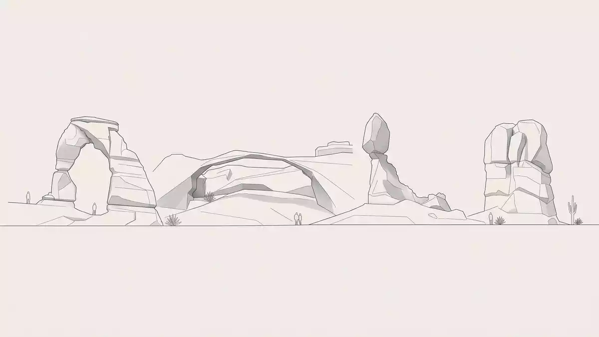
Arches National Park near Moab in eastern Utah is a desert landscape where red sandstone has been carved into arches, fins and balanced rocks above an ancient underground salt bed. The area was first protected as Arches National Monument in 1929 and redesignated as a national park in 1971, giving formal status to a landscape that had taken shape over geological time.
Sandstone arches in a compact desert landscape
The defining feature of Arches National Park is the concentration of natural sandstone arches scattered across a relatively compact area of the Colorado Plateau. The park covers a little over 300 square kilometres, with hundreds of catalogued arches that span at least one metre and many smaller openings in the surrounding cliffs and fins.Largest concentration of natural stone arches Visitors encounter arches in different states of formation, from narrow slits opening in rock fins to fully developed spans and collapsed remnants that hint at their former shapes.More than two thousand sandstone arches
The arches themselves are carved mainly from Entrada Sandstone, a copper-coloured rock that formed in the Jurassic period from ancient dunes and coastal desert sands.Entrada Sandstone and arch-bearing units This rock tends to weather into tall, narrow fins along parallel fractures, setting the stage for openings to develop where erosion exploits weaker zones. In places the spans reach tens of metres, with thin ribbons of stone crossing sky between massive abutments, while elsewhere small arches appear almost as details in a wider cliff face.
Geology written in salt, sand and time
The wider landscape of Arches National Park reflects the interaction between thick sedimentary layers and an underlying salt formation. Beneath the park lies the Paradox Formation, a deep sequence of salt and other evaporite minerals laid down around 300 million years ago when a sea flooded the region and then evaporated.Underground salt bed of the Paradox Basin Over geological time this plastic salt has flowed and bulged, creating salt-cored anticlines in areas such as Salt Valley and Cache Valley. As the salt structures collapsed and dissolved, the overlying sandstone fractured and subsided, producing the distinctive pattern of parallel fins and monoliths seen across the park.Salt anticlines shaping the park's geology
On the surface, several sedimentary formations appear in cliffs and mesas, but the Navajo Sandstone and Entrada Sandstone dominate the scenery. Entrada, especially its Slick Rock Member, carries most of the arches and fins, while older units such as the Carmel Formation and Curtis Formation also contribute to the stepped profiles and colour contrasts in the canyon walls.Named geologic units hosting arches The arid climate reduces vegetation cover, leaving the rock forms clearly visible, from squat balanced boulders perched on narrow necks to long ridges cut by slot-like gaps that gradually widen into window-like openings.
From national monument to national park
Although the rock formations took shape over vast spans of time, Arches National Park has a relatively recent administrative history. On 12 April 1929 President Herbert Hoover issued Presidential Proclamation 1,875, establishing Arches National Monument to protect notable examples of natural arches and related features northeast of Moab.Proclamation establishing Arches National Monument in 1929 Over the following decades, boundary adjustments brought more of the surrounding plateau within the protected area, reflecting an expanding understanding of the geological system behind the arches.
On 12 November 1971 Arches was redesignated as a national park when Congress passed Public Law 92-155, which President Richard M. Nixon signed into law.Public Law 92-155 establishing Arches National Park The change in status recognised the wider significance of the landscape, from its dense concentrations of arches to the broader array of fins, spires, mesas and canyons influenced by the underlying salt bed. Today the park forms part of the network of protected areas on the Colorado Plateau and sits close to other well-known desert parks and monuments around Moab.
Visiting Arches National Park: what travellers from Western Europe should know
- Arches National Park lies north of Moab in south-eastern Utah, reached by road from the town and regional highways that follow the Colorado Plateau.
- The terrain consists of dry desert with rocky ground, sandstone slopes and established trails leading to viewpoints and arches.
- Nearby landscapes include the Colorado River corridor and other protected desert areas around Moab.
- The official language is English and the currency is the United States dollar.
- Entry requirements depend on your nationality; UK travellers can check the FCDO travel advice at gov.uk/foreign-travel-advice, Irish travellers the Department of Foreign Affairs at ireland.ie.
Searching for Arches National Park on social platforms
These links open searches for Arches National Park on each platform.
Frequently asked questions about Arches National Park
Where is Arches National Park located?
Arches National Park is in south-eastern Utah in the United States, just north of the town of Moab on the Colorado Plateau.
What can visitors expect to see on a visit?
Visitors encounter red sandstone cliffs, fins, balanced rocks and a high concentration of natural arches, many formed in Entrada Sandstone above an underground salt bed.
What makes Arches National Park distinctive among desert parks?
The park sits over the Paradox Formation salt bed and combines salt-affected geology with hundreds of arches in a relatively small area around Moab.


