
Dujiangyan and the ancient art of dividing a river
Published on 09/23/2026 at 22:44 | Editorial responsibility: Rafael Müller, Editor-in-Chief AD HOC NEWS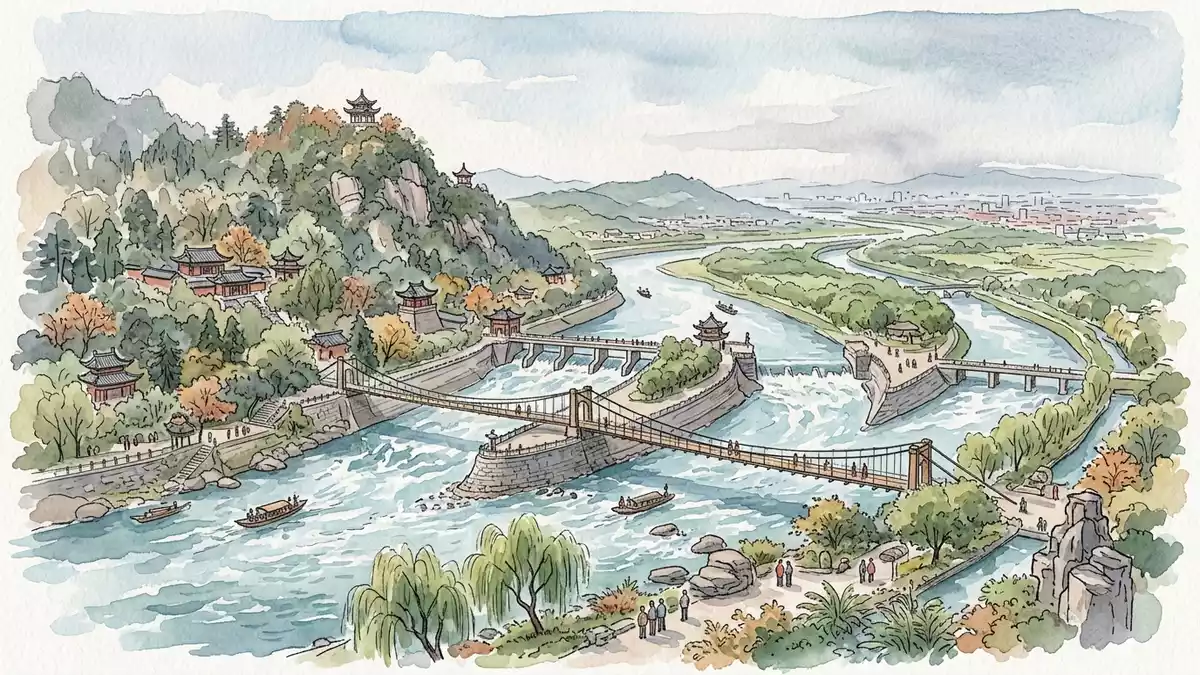
Dujiangyan is an ancient irrigation system on the Minjiang River near Chengdu, where water is divided through channels, weirs and a levee. Initiated in 256 BC under Li Bing during the Qin Dynasty, it remains a functioning landscape of engineering, agriculture and river management.
Dujiangyan begins with the Minjiang River
The system lies in western Sichuan, at the meeting point of the Chengdu flatlands and the highlands beyond the Sichuan Basin. Its setting joins fast-moving river water, a cut through Mount Yulei and broad agricultural land into one connected landscape.
The river works are not centred on a single monumental dam. Their visible elements include Yuzui, the Fish-Mouth Levee, Feishayan, the Flying-Sand Weir, and Baopingkou, the Bottle-Neck Channel. Together, these structures divide, redirect and regulate water across the irrigation network. UNESCO’s Dujiangyan description places the system in the western portion of the Chengdu flatlands and dates its construction to around 256 BC.
Li Bing’s Qin-era waterworks
Li Bing was the Shu Kingdom magistrate responsible for the project during the Warring States period. The work included cutting the Lidui platform, excavating channels and opening a navigation route along the Minjiang River.
The system’s historical importance lies in its combination of flood control, irrigation and navigation. Water passes through a network of engineered channels instead of being held behind a conventional barrier. The arrangement connects the river with farmland across the Chengdu Plain. Li Bing’s 256 BCE project belongs to the early history of large-scale hydraulic engineering in China.
Work continued after Li Bing’s administration. Wen Weng extended the system in 141 BCE, adding to an irrigation landscape that had already become part of the region’s agricultural infrastructure.
A living heritage landscape beside Chengdu
Dujiangyan is encountered as a sequence of water, stone, channels and riverbanks. The Fish-Mouth Levee divides the Minjiang River, while the Flying-Sand Weir and Bottle-Neck Channel form further parts of the water-control system.
Mount Yulei, the Lidui platform and the river channel give the site a strong relationship between built form and terrain. Bridges and paths connect viewpoints across the waterworks, while the surrounding city of Dujiangyan provides an urban setting for the historic system.
Mount Qingcheng and the Dujiangyan Irrigation System share a UNESCO World Heritage inscription from 2000. The designation places hydraulic engineering and sacred mountain culture within the same heritage landscape. the 2000 World Heritage inscription records the connection between the irrigation system and Mount Qingcheng.
Visiting Dujiangyan: what travellers from Western Europe should know
- Dujiangyan lies west of Chengdu on the Minjiang River. Intercity trains from Chengdu serve Dujiangyan, including Lidui Park Station near the irrigation area.
- The site combines river crossings, paved paths, bridges and stairways. The route includes exposed water channels, stone embankments and viewpoints around the working hydraulic structures.
- The official language is Mandarin Chinese and the currency is the Chinese yuan.
- Entry requirements depend on your nationality; UK travellers can check the FCDO travel advice at gov.uk/foreign-travel-advice, Irish travellers the Department of Foreign Affairs at ireland.ie.
Searching for Dujiangyan on social platforms
These links open searches for Dujiangyan on each platform.Frequently asked questions about Dujiangyan
Where is Dujiangyan?
Dujiangyan is on the Minjiang River in Sichuan, west of Chengdu. The irrigation system lies within the city named Dujiangyan.
What can visitors expect at Dujiangyan?
Visitors encounter river channels, weirs, bridges, embankments and paths around an operating irrigation system. The landscape also includes Mount Yulei and the Lidui platform.
What makes Dujiangyan distinctive?
Its hydraulic design divides and redirects river water without a conventional dam. Li Bing initiated the system in 256 BC during the Qin Dynasty, and the site remains connected with irrigation, navigation and flood control.


