
Everglades National Park and the river of grass
Published on 09/22/2026 at 08:43 | Editorial responsibility: Rafael Müller, Editor-in-Chief AD HOC NEWS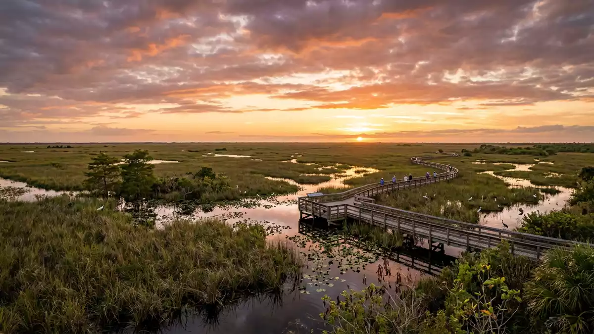
Everglades National Park is a landscape in motion without a visible river channel. South of Homestead, shallow water crosses sawgrass marshes, hardwood hammocks, mangrove forests and Florida Bay before reaching the sea. The park was established in 1947, and its waterways, wetlands and forests remain its defining geography.
Sawgrass, shallow water and the southern Florida landscape
The Everglades occupies the southern tip of Florida, where freshwater wetlands meet brackish lagoons, mangrove coast and marine habitats. Its broad marshes are marked by sawgrass, while slightly raised tree islands carry tropical hardwoods above the wetland.
The landscape includes freshwater sloughs, sawgrass prairies, pine rocklands, tropical hardwood hammocks, mangrove estuaries and seagrass meadows. The park protects about 1.5 million acres of wetland, forest and marine habitat, with the park’s protected habitats extending across a large part of southern Florida.
Water is present in several forms rather than as one continuous open stream. In the interior, sawgrass rises from shallow freshwater. Along the coast, mangrove roots occupy tidal channels and islands. Florida Bay forms a broad transition between the mainland and the Florida Keys.
From the 1947 park to an international landscape
Congress authorised Everglades National Park in 1934. President Harry S. Truman dedicated it on 6 December 1947 at Everglades City, marking the creation of a national park centred on an ecological system.
Ernest F. Coe was a leading figure in the campaign for protection, while Marjory Stoneman Douglas gave the wider Everglades a lasting public vocabulary through her 1947 book, The Everglades: River of Grass. Her name is also attached to the Gulf Coast visitor centre.
The park entered the UNESCO World Heritage List in 1979. It is also recognised as an International Biosphere Reserve and a Wetland of International Importance, reflecting the connection between freshwater marsh, estuary, mangrove and coastal waters.
The cultural landscape reaches further back than the national park. The Calusa lived along south-west Florida’s coast, including the Ten Thousand Islands, while Seminole and Miccosukee communities have long-standing connections with the wider Everglades region. Shell works, canoe routes and tree islands form part of this human history.
Mangroves, hammocks and wildlife between land and sea
The park’s ecological character comes from its meeting points. Freshwater habitats occupy the interior, tropical hardwood hammocks appear on raised ground, and mangroves form dense coastal margins. Each setting has its own plants, water depth and animal communities.
Mangrove forests dominate sections of the coast, with prop roots and tidal channels creating a landscape that can be explored by boat or kayak. In the north, sawgrass and freshwater marshes surround the Shark Valley area. Pine rocklands and hardwood hammocks add dry ground and shade to the wider wetland.
Wildlife associated with the park includes American alligators, American crocodiles, West Indian manatees, wood storks and the Florida panther. Birds include herons, egrets, anhingas and other wading species. The park also marks a meeting point between temperate North American wildlife and tropical species from the Caribbean.
The Anhinga Trail near Royal Palm crosses sawgrass marsh on a boardwalk and short paved route. The trail is linked with views of open water, marsh vegetation and wildlife, while the nearby Gumbo Limbo Trail enters a hardwood hammock. At Flamingo, coastal paths and waterways lead towards mangrove country.
Visiting Everglades National Park: what travellers from Western Europe should know
- The Homestead entrance lies south of Miami near Florida City and is reached by road via U.S. 1 and State Road 9336. This entrance connects with Royal Palm and the road towards Flamingo.
- Shark Valley is reached from U.S. 41, also called Tamiami Trail, west of Miami. The Gulf Coast entrance is reached through Everglades City and opens onto mangrove waterways.
- Terrain changes across the park. Boardwalks cross marsh and hardwood habitats, while canoe routes enter shallow channels, mangrove passages and remote coastal waters.
- The official language is English and the currency is the US dollar.
Searching for Everglades National Park on social platforms
These links open searches for Everglades National Park on each platform.Frequently asked questions about Everglades National Park
Where is Everglades National Park?
It occupies the southern tip of Florida, with the Homestead entrance south-west of Miami. Other access areas lie at Shark Valley and Everglades City.
What can visitors expect on a visit?
The park contains boardwalks, short trails, coastal paths, freshwater marshes and waterways. Travel across the landscape may involve walking, cycling, canoeing or boating.
What makes the park distinctive?
Everglades National Park joins sawgrass wetlands, tropical hardwood hammocks, mangrove forests and marine habitats within one protected landscape. Its international designations recognise this connected ecological system.


