
Farangi Samarias, the limestone gorge from plateau to sea
Published on 09/23/2026 at 20:57 | Editorial responsibility: Rafael Müller, Editor-in-Chief AD HOC NEWS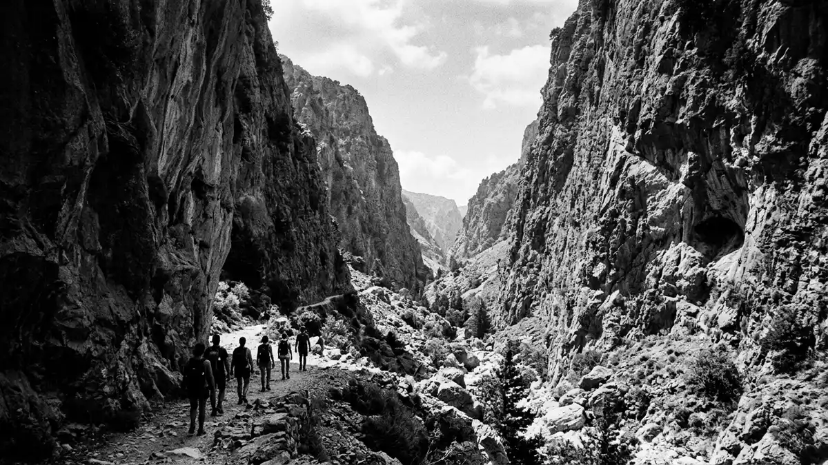
Farangi Samarias is a limestone gorge in south-western Kreta, descending from the Omalos Plateau towards the Libyan Sea. The landscape changes from high Mediterranean forest to steep rock walls and narrow passages, creating a continuous route between mountain and coast.
Farangi Samarias begins high on the Omalos Plateau
The northern entrance lies at Xyloskalo, on the southern edge of the Omalos Plateau. The route begins at about 1,200 m (3,937 ft) above sea level and continues towards Agia Roumeli on the coast. The name Xyloskalo refers to a historic staircase associated with the entrance.
The full route to Agia Roumeli is 16 km (9.9 miles), while the gorge itself measures about 12.5 km (7.8 miles). The path crosses the White Mountains, known in Greek as the Lefka Ori, with the terrain changing from open upland to ravines, streams and limestone walls. the route to Agia Roumeli carries the descent to the sea.
Limestone, water and Mediterranean forest
Farangi Samarias belongs to a mountainous limestone landscape shaped by steep relief, springs, torrents and karstic caves. The wider area rises from sea level to 2,134 m (7,001 ft), giving the protected landscape a broad vertical range. the limestone mountain landscape includes high-altitude Mediterranean forest, maquis and phrygana.
Cypress and pine grow among shrubs such as Pistacia and Cistus. The gorge also provides habitat for the endemic Cretan wild goat, Capra aegagrus cretensis, together with other Mediterranean animals. Rock, water and vegetation appear in close sequence along the route, giving each section a distinct physical character.
A national park with a long human history
Samaria National Park was established in 1962. The protected area became a UNESCO Biosphere Reserve in 1981, linking the gorge with a wider landscape of mountains, coast, archaeological remains, churches and older settlements. ancient remains at Agia Roumeli include evidence connected with Tarra, an ancient settlement at the coast.
Human activity inside and around the gorge reaches back to antiquity. Ruins, religious buildings and traces of older habitation form part of the cultural landscape alongside the natural route. The settlement of Samaria, situated within the gorge, gives Farangi Samarias its name.
Visiting Farangi Samarias: what travellers from Western Europe should know
- Farangi Samarias lies in south-western Kreta. The northern approach reaches Xyloskalo on the Omalos Plateau, while the southern route ends at Agia Roumeli on the Libyan Sea.
- The walk descends from about 1,200 m (3,937 ft) to sea level across 16 km (9.9 miles). It includes steep ground, rock surfaces, streams and narrow sections of gorge.
- The official language is Greek and the currency is the euro.
- The protected landscape includes cypress forest, pine, springs, torrents, limestone cliffs and habitat for the Cretan wild goat.
Searching for Farangi Samarias on social platforms
These links open searches for Farangi Samarias on each platform.
Frequently asked questions about Farangi Samarias
Where is Farangi Samarias?
Farangi Samarias lies in south-western Kreta, within the White Mountains. Its route links the Omalos Plateau with Agia Roumeli and the Libyan Sea.
What does a visit involve?
A visit involves a long downhill walk across limestone terrain, streams, forest, ravines and narrow rock passages. The full route to Agia Roumeli is 16 km (9.9 miles).
What makes Farangi Samarias distinctive?
Its distinctive character comes from the sequence of high plateau, Mediterranean forest, limestone gorge and coastal exit. The area also combines national-park protection with a UNESCO Biosphere Reserve designation.


