
Freedom Trail in Boston as a walk through American history
Published on 09/19/2026 at 16:21 | Editorial responsibility: Rafael Müller, Editor-in-Chief AD HOC NEWS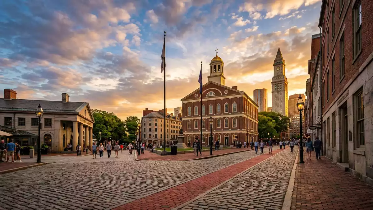
Freedom Trail in Boston is a marked walking route that threads through central streets and harbour-side districts to connect some of the most important sites of the American Revolution and early United States history.marked walking route Laid out in the mid-twentieth century, it follows a continuous red line that leads from the green expanse of Boston Common towards Charlestown and the granite obelisk of the Bunker Hill Monument.Freedom Trail
A red line through Boston’s revolutionary heart
The defining feature of Freedom Trail is the red stripe underfoot, formed by bricks or paint, that guides walkers from site to site without the need for signs or maps.red line marked by paint or red bricks It runs for about 4 km (2.5 miles) and links a sequence of historic landmarks where events of the eighteenth century left concrete traces in stone, timber and bronze.2.5-mile-long path
The route was officially dedicated on 11 June 1951 by Boston’s mayor John B. Hynes, giving the city a structured way to present its colonial and revolutionary heritage to visitors.officially dedicated on 11 June 1951 Later in the 1950s the red surface markings were added, turning an itinerary into a physical line that weaves past churches, burial grounds, civic buildings and a warship in the harbour.
From Boston Common to harbour and hill
Freedom Trail begins at Boston Common, the city’s central public park and the oldest public park in the United States, then climbs towards the golden dome of the Massachusetts State House before turning into streets lined with churches and brick facades.Boston Common and Massachusetts State House Park Street Church, with its nineteenth-century steeple, and the neighbouring Granary Burying Ground introduce the religious and memorial landscape of colonial Boston.
Further along, Freedom Trail passes King’s Chapel and its burying ground, the site of Boston Latin School marked by the statue of Benjamin Franklin, and the Old Corner Bookstore, one of the city’s older surviving commercial buildings.King’s Chapel and Old Corner Bookstore Civic history comes into view at Old South Meeting House and Old State House, close to the marked Boston Massacre Site, before the line reaches Faneuil Hall and moves on through the North End towards the Paul Revere House, Old North Church and Copp’s Hill Burying Ground, eventually crossing the water to the USS Constitution and the Bunker Hill Monument.sequence of 16 sites
Walking a compact cross-section of American history
Freedom Trail is organised around 16 official historic sites, giving a compact cross-section of locations linked to the lead-up to the American Revolution, the conflict itself and the early life of the United States.16 locations significant to the history of the United States The Bunker Hill Monument in Charlestown marks the battle fought on 17 June 1775, while the eighteenth-century frigate USS Constitution, launched in 1797, represents the young nation’s naval power in Boston Harbour.Bunker Hill Monument and USS Constitution
Along the way, Freedom Trail brings together meeting houses where protests were planned, former sites of government, marking stones for the Boston Massacre and quiet burial grounds where figures such as Samuel Adams are interred, creating an unusually dense sequence of eighteenth-century sites within a walkable area of a modern city.demarcated red brick line connecting sites For travellers from Western Europe, the trail offers a structured introduction to the architecture, political culture and commemorative landscape of Boston without leaving the urban core.
Visiting Freedom Trail: what travellers from Western Europe should know
- Freedom Trail runs through central Boston, beginning at Boston Common and reaching into Charlestown; the route is designed for exploration on foot along city pavements.
- Much of the trail follows ordinary streets and park paths, but certain sites such as towers or monuments involve staircases and uneven historic interiors.
- Freedom Trail lies within the United States of America; the official language is English and the currency is the US dollar.
- Entry requirements depend on your nationality; UK travellers can check the FCDO travel advice at gov.uk/foreign-travel-advice, Irish travellers the Department of Foreign Affairs at ireland.ie.
Searching for Freedom Trail on social platforms
These links open searches for Freedom Trail on each platform.
Frequently asked questions about Freedom Trail
Where is Freedom Trail located?
Freedom Trail is a marked walking route in Boston, Massachusetts, in the United States, running from Boston Common through central districts to Charlestown.
What can visitors expect when walking Freedom Trail?
Visitors follow a red line on streets and paths that links churches, burial grounds, civic buildings and harbour-side sites connected to the American Revolution.
What makes Freedom Trail distinctive among historic walks?
The combination of a continuous marked route, 16 official historic sites and major landmarks such as USS Constitution and the Bunker Hill Monument gives it an unusually dense historical focus.


