
Glacier National Park and the high spine of the Rockies
Published on 09/17/2026 at 09:51 | Editorial responsibility: Rafael Müller, Editor-in-Chief AD HOC NEWS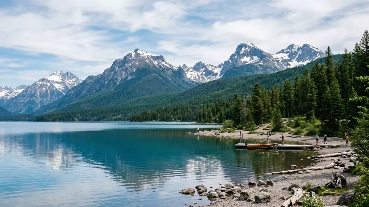
Glacier National Park in northwestern Montana sets a dramatic stage where high Rocky Mountain ridges, deep glacial valleys and bright lakes meet along the border with Canada. Established as a United States national park in 1910, it forms part of the wider Waterton-Glacier International Peace Park and stretches across a large swathe of the northern Rockies.
The “Crown of the Continent” and the Continental Divide
Glacier National Park occupies a belt of the northern Rocky Mountains on the border between Montana and the Canadian provinces of Alberta and British Columbia, joining directly with Waterton Lakes National Park to the north.border between Montana and Canada Its landscape is frequently described through the phrase “Crown of the Continent”, signalling the way its ridges form a high hub from which rivers flow in several directions across North America.Crown of the Continent
The park straddles the Continental Divide, the major watershed line of the Rocky Mountains that separates drainage towards the Pacific Ocean from drainage towards the interior basins of the continent.straddles the Continental Divide Within Glacier National Park this divide is not a single ridge but a series of high summits and passes, and along it lie some of the park’s most exposed rock, snow and ice fields. Elevations range from forested valley floors under 1,000 m (3,281 ft) to high peaks rising above 3,000 m (9,843 ft), giving travellers a strong sense of vertical scale between river corridors and the alpine skyline.elevations range from valley floors
Ice-shaped valleys, overthrust mountains and bright lakes
The park’s relief is visibly the product of glacial erosion, with U-shaped valleys, sharp ridges and horn-like peaks that record the work of Ice Age glaciers in carving through older rock layers.U-shaped valleys and horn-shaped peaks Many valleys carry long lakes that follow the line of former ice tongues, while cliffs and cirques rise above them in stepped tiers. Smaller modern glaciers still cling to certain high slopes, although they now occupy only a fraction of their former extent and sit as patches of ice above talus and snowfields.
Two main mountain ranges, the Lewis and the Livingston, run through Glacier National Park and give it a distinctive layered skyline, with long ridges trending broadly northwest to southeast.Lewis and Livingston ranges Geologically, the park is marked by the Lewis Overthrust fault, where older Precambrian sedimentary rocks have been displaced eastwards over younger Cretaceous formations, creating striking colour contrasts and banded cliffs in many valley walls.Lewis Overthrust fault With more than 130 named lakes scattered across its basins and shelves, Glacier National Park combines this complex geology with extensive water surfaces surrounded by forests and subalpine meadows.more than 130 named lakes
From 1910 national park to Waterton-Glacier Peace Park
Glacier National Park was established by the United States Congress on 11 May 1910, becoming the tenth national park in the country and protecting a large tract of mountainous terrain in northwestern Montana.established by Congress on 11 May 1910 Its protected area covers about 1,583 square miles (around 4,100 square km), with a long outer boundary following rivers, forest edges and the international border.1,583 square miles The park’s northern edge connects directly to Waterton Lakes National Park in Alberta, and the two were formally linked in 1932 as the Waterton-Glacier International Peace Park, a cross-border protected area recognising shared landscapes and ecosystems.Waterton-Glacier International Peace Park
Within the park’s management documents, Glacier National Park is described as protecting significant wilderness character, with much of its area functioning as de facto wilderness despite the presence of roads and facilities along certain corridors.defacto wilderness acreage The combination of mountain, forest and river environments supports a wide range of plant and animal species, including large mammals adapted to high-country terrain and extensive coniferous forests. Contacts with neighbouring lands are clearly defined: to the east lies the Blackfeet Indian Reservation, while national forests border the park on other sides.borders with reservation and forests
Visiting Glacier National Park: what travellers from Western Europe should know
- Glacier National Park is reached from the west via U.S. Highway 2, which runs north from Kalispell to West Glacier and the park’s western entrance.
- The terrain ranges from low forested valleys to high passes above 2,000 m (6,562 ft), and many trails involve sustained gradients and sections of rocky ground.
- West Glacier lies in the state of Montana in the United States; the official language is English and the currency is the US dollar.
- Major features such as Logan Pass stand at over 2,000 m (6,562 ft), so visitors encounter significant altitude differences between valley floors and the Continental Divide.
- Entry requirements depend on your nationality; UK travellers can check the FCDO travel advice at gov.uk/foreign-travel-advice, Irish travellers the Department of Foreign Affairs at ireland.ie.
Searching for Glacier National Park on social platforms
These links open searches for Glacier National Park on each platform.
Frequently asked questions about Glacier National Park
Where is Glacier National Park?
Glacier National Park is in northwestern Montana, along the border with Canada, with West Glacier serving as a key western access point.
What kind of landscape does Glacier National Park offer?
The park combines steep Rocky Mountain ranges, glacial valleys, rivers and lakes, with elevations rising from forested lowlands to high alpine summits.
What makes Glacier National Park distinctive among North American parks?
Its position on the Continental Divide, the Lewis Overthrust geology and its cross-border link with Waterton Lakes National Park give it a striking combination of ridges, watersheds and international protected status.


