
Guna Yala: an Indigenous territory spread between forest and sea
Published on 09/23/2026 at 23:19 | Editorial responsibility: Rafael Müller, Editor-in-Chief AD HOC NEWS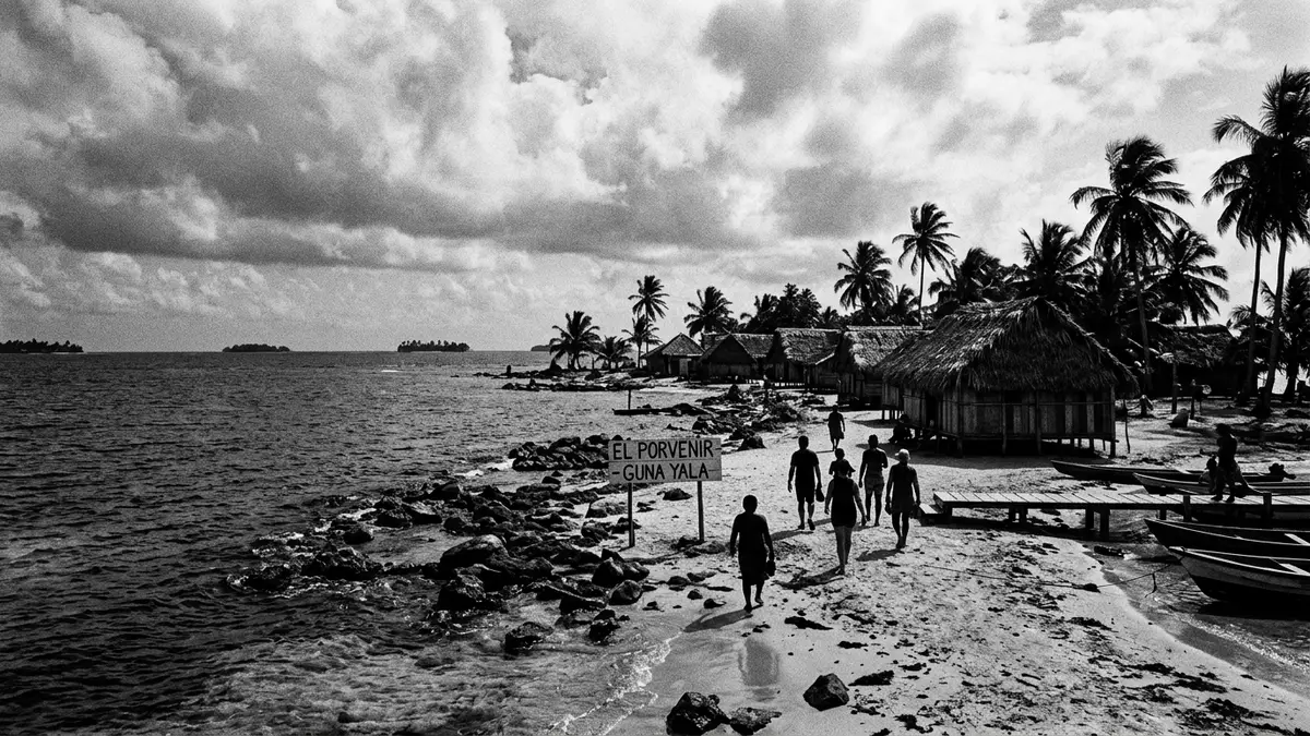
Guna Yala is an Indigenous territory on Panama’s north-eastern Caribbean coast, where a narrow mainland strip meets an archipelago of low islands. El Porvenir sits on a small island near the western end, linking administrative buildings, an airstrip and nearby Guna communities.
Guna Yala between mainland forest and Caribbean islands
The territory follows the Caribbean shoreline towards Colombia. Its landscape combines forested mainland, shallow coastal waters, reefs, sandy cays and settled islands. The sea is not a separate backdrop to Guna Yala; it forms part of the territory’s geography and daily movement.
Guna Yala covers about 2,306 square kilometres and includes a long coastal strip with an island chain offshore. A 2010 territorial description records 365 islands, with 36 inhabited. The figures describe a dispersed region rather than a single compact resort settlement, and the distance between mainland and island communities gives the comarca its distinctive spatial character. The territorial geography of Guna Yala includes agriculture, fishing, craft production and tourism.
El Porvenir, an island administrative centre
El Porvenir is a small island close to the mainland and serves as an administrative centre for Guna Yala. Government offices, an airstrip, small shops and basic services occupy a limited area, while jetties connect the island with boats moving through the surrounding waters.
The island is not a separate attraction detached from its region. It is part of the political and cultural geography of the comarca, and its compact settlement reflects the practical importance of administration within an archipelago. The western end of Guna Yala includes communities such as Cartí Suitupo and Río Sidra, while the mainland rises behind the coastal islands.
Access to El Porvenir combines domestic air travel, roads on the Panamanian mainland and boat journeys between coastal points and islands. The location of El Porvenir near the western end makes it a recognised gateway to the island region.
Guna identity, autonomy and the language of mola cloth
Guna Yala is a comarca indígena, an Indigenous territorial division within Panama. Its legal history reaches back to 1938, when the Comarca de San Blas was established. Law No. 16 of 1953 defined its administration and boundaries, while the territory’s political life developed through Guna institutions, including the Guna General Congress.
The name changed from San Blas to Kuna Yala in 1998 and to Guna Yala in 2010. These names belong to different stages of the territory’s public history, while Guna identity remains central to its cultural and political character. The history of Guna autonomy includes the Dule Revolution of 1925 and the creation of a special territorial regime.
Molas provide one of the clearest cultural expressions associated with Guna Yala. These hand-stitched textile panels form part of traditional clothing and carry layered designs connected with everyday life, Guna cosmology and community identity. Women and omeguid manufacturers produce molas for clothing and sale, making the panels both cultural objects and household income.
The cloth is built from coloured fabric arranged in layers, with cut sections revealing patterns beneath. Designs may include animals, plants, human figures, geometric elements or scenes from daily life. A mola is therefore more than a decorative souvenir: it records a visual vocabulary connected with Guna experience and cultural continuity. The tradition of Guna molas also carries a symbolic link with Indigenous identity and resistance to colonialism.
Visiting Guna Yala: what travellers from Western Europe should know
- Guna Yala lies along Panama’s north-eastern Caribbean coast. El Porvenir is reached by domestic flight, by road towards the mainland coast, and by boat within the archipelago.
- Travel through the region involves jetties, small boats, shallow coastal waters and low-lying islands. El Porvenir itself is compact, with buildings and an airstrip concentrated on a narrow island.
- The official language is Spanish and the currency is the Panamanian balboa, used alongside the United States dollar.
- Entry requirements depend on your nationality; UK travellers can check the FCDO travel advice at gov.uk/foreign-travel-advice, Irish travellers the Department of Foreign Affairs at ireland.ie.
Searching for Guna Yala on social platforms
These links open searches for Guna Yala on each platform.
Frequently asked questions about Guna Yala
Where is Guna Yala?
Guna Yala lies on Panama’s north-eastern Caribbean coast, between the mainland forest and an offshore archipelago reaching towards Colombia. El Porvenir occupies a small island near the western end.
What can visitors expect in Guna Yala?
Visitors encounter low islands, coastal waters, boat connections, compact settlements and Guna cultural traditions. El Porvenir combines an airstrip, administrative buildings, jetties and small local services.
What makes Guna Yala distinctive?
Its distinctive character comes from the combination of Indigenous autonomy, island geography and Guna cultural expression. Mola textiles connect clothing, visual design, identity and family income.


