Guna Yala’s islands and seascapes around El Porvenir
Published on 08/08/2026 at 15:03 | Editorial responsibility: Rafael Müller, Editor-in-Chief AD HOC NEWS
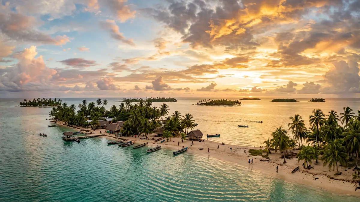
Guna Yala is the autonomous Guna territory on Panama’s Caribbean side, and El Porvenir is one of its best-known settlement points. The setting is a chain of low islands, coral shallows and seawater passages, with wooden buildings close to the shore.
El Porvenir and the island landscape of Guna Yala
El Porvenir introduces Guna Yala through water, sand and low-lying land rather than through roads or large civic spaces. The name belongs to a lived archipelago, where the built environment stays close to the coast and the horizon stays open.
The territory is associated with the Guna people, whose presence in the region reaches back for generations. Panama’s Caribbean side gives the area its maritime character, and the settlement pattern makes boats part of everyday movement.
Guna culture, authority and place
The Guna are one of Panama’s Indigenous peoples, and Guna Yala is the political and cultural name of their territory. That status matters in the landscape: village life, shoreline, sea routes and local authority all sit together in the same frame.
El Porvenir is a useful point of reference because it links the idea of a place-name to a real settlement rather than to an abstract map label. Visitors encounter a coastal community with simple structures, narrow land strips and the visual dominance of water.
A seascape shaped by islands rather than roads
The strongest impression in Guna Yala is the relation between land and water. Islands are small, shorelines are close, and movement depends on boats more than on highways.
That geography also means the place reads as a sequence of viewpoints: docks, beach edges, palm-fringed shorelines and open sea. El Porvenir belongs to that sequence, giving the territory a clear arrival point for travellers who come by water.
Visiting Guna Yala: what travellers from Western Europe should know
- Guna Yala lies on Panama’s Caribbean coast, and El Porvenir is reached by road and then by boat through the territory’s islands.
- Admission arrangements and opening hours are set by the site's operator and change with the season; the official website is the only binding source.
- The dry season is the clearest time for sea travel and island views, while the wet season brings more changeable conditions.
- Expect short walks on sand, uneven ground and movement between shore and boat.
- Spanish is useful, and cash is sensible for small local purchases; respect local customs and community rules.
- Entry requirements depend on your nationality. UK travellers should check the FCDO travel advice at gov.uk/foreign-travel-advice; Irish travellers the Department of Foreign Affairs at ireland.ie; EU and EEA citizens their own national foreign ministry.
Searching for Guna Yala on social platforms
These links open searches for Guna Yala on each platform.
Frequently asked questions about Guna Yala
Where is Guna Yala?
Guna Yala is on Panama’s Caribbean side, with El Porvenir among its recognised settlement points. It is an island territory rather than a mainland city.
What should a visit feel like?
Expect sea crossings, simple buildings, sandy ground and a strong coastal setting. The place feels more like a lived archipelago than a resort strip.
What makes Guna Yala distinctive?
The combination of Indigenous territory, island geography and community life gives Guna Yala its character. El Porvenir helps make that identity legible from the first arrival.