
Gunung Rinjani and the lake inside its volcanic caldera
Published on 09/23/2026 at 14:14 | Editorial responsibility: Rafael Müller, Editor-in-Chief AD HOC NEWS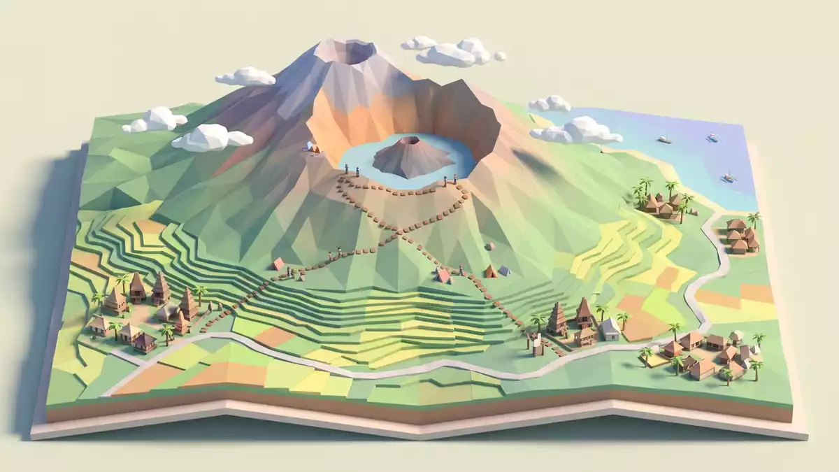
Gunung Rinjani rises across northern Lombok as a volcanic massif whose summit stands above a broad caldera. At 3,726 m (12,224 ft), the mountain overlooks Segara Anak, a lake occupying the high interior of the volcanic complex.
Gunung Rinjani: a summit above a volcanic basin
The mountain’s most distinctive feature is the contrast between its high summit ridge and the wide hollow beside it. Gunung Rinjani reaches 3,726 m above sea level, while the caldera spreads across the upper mountain landscape.
The summit is part of a compound volcano rather than an isolated cone. Long ridges, steep volcanic slopes and broken high ground surround the caldera, with the western side opening towards the lake. The form is especially clear from elevated routes on the mountain.
Gunung Rinjani belongs to the volcanic arc of Indonesia’s Lesser Sunda Islands. Its rocks and landforms record successive phases of volcanic growth, collapse and renewed activity. The wider Rinjani-Lombok region carries UNESCO Global Geopark designation from 2018, linking its geology with Lombok’s natural and cultural landscape. UNESCO Global Geopark
Segara Anak and the cones within the caldera
Segara Anak occupies part of the caldera at an elevation close to 2,000 m. Its surface covers about 11 square kilometres, and its deep water sits beneath cliffs, ridges and volcanic slopes.
The lake’s name means “Child of the Sea”. A younger volcanic cone rises within the caldera beside the water, creating a second volcanic form inside the much larger basin. Hot springs occur along the lake shore, and gas bubbles have been recorded in the water.
The caldera formed during the eruption of Samalas in 1257 CE. That event reshaped Lombok’s volcanic landscape and left a large depression in the mountain complex. Segara Anak occupies the western part of this depression, while younger cones mark continuing volcanic activity inside it. the 1257 CE eruption
Historical activity has been associated with the cones within the caldera, including Barujari. The relationship between the lake, hot springs and volcanic vents gives Gunung Rinjani a landscape in which water and fire appear within the same enclosed basin.
Forests, grasslands and Sasak culture on Lombok
Gunung Rinjani National Park contains a changing sequence of habitats around the mountain. Tropical forests cover lower and middle elevations, while montane vegetation and open grasslands occur higher on the slopes.
The protected landscape forms part of the Rinjani-Lombok UNESCO Global Geopark, which covers volcanic terrain, waterfalls, forest and coastal environments. The geopark also includes places connected with Sasak culture, the heritage of Lombok’s principal indigenous population.
Traditional crafts from Lombok include tenun ikat, songket and woven work made from ketak fern. These practices sit alongside the mountain’s geological identity, placing Gunung Rinjani within a wider cultural landscape rather than treating it as a summit alone.
The mountain’s appearance changes across its sides. From the east, the profile is steep and conical. Towards the west, the caldera interrupts the volcanic form, opening onto Segara Anak and the younger cones within it. Rinjani’s highest peak
Visiting Gunung Rinjani: what travellers from Western Europe should know
- Gunung Rinjani rises in northern Lombok, Indonesia. Road approaches lead from Lombok’s villages towards trail areas on the mountain’s eastern, northern and western sides.
- The terrain includes steep volcanic slopes, loose rock, exposed ridges and high-elevation paths. Routes to the summit and Segara Anak require sustained walking at altitude.
- Segara Anak lies inside the caldera, below the summit ridge. Reaching the lake involves descending from the crater rim and crossing uneven volcanic ground.
- The official language is Indonesian and the currency is the Indonesian rupiah.
- Conditions on the mountain change with the seasons; the local cable-car operators and alpine clubs provide information.
Searching for Gunung Rinjani on social platforms
These links open searches for Gunung Rinjani on each platform.
Frequently asked questions about Gunung Rinjani
Where is Gunung Rinjani?
Gunung Rinjani is in northern Lombok, an Indonesian island in the Lesser Sunda Islands. The mountain forms the central landscape of Gunung Rinjani National Park.
What does a visit to Gunung Rinjani involve?
A visit involves mountain terrain, steep paths, volcanic rock and substantial walking at altitude. Routes can include the crater rim, the summit ridge and the descent towards Segara Anak.
What makes Gunung Rinjani distinctive?
Its 3,726 m summit rises beside a broad volcanic caldera containing Segara Anak lake and younger cones. The mountain combines high ridges, forests, grasslands and active volcanic features.


