
Isla de Ometepe and its twin volcanic peaks
Published on 09/22/2026 at 08:10 | Editorial responsibility: Rafael Müller, Editor-in-Chief AD HOC NEWS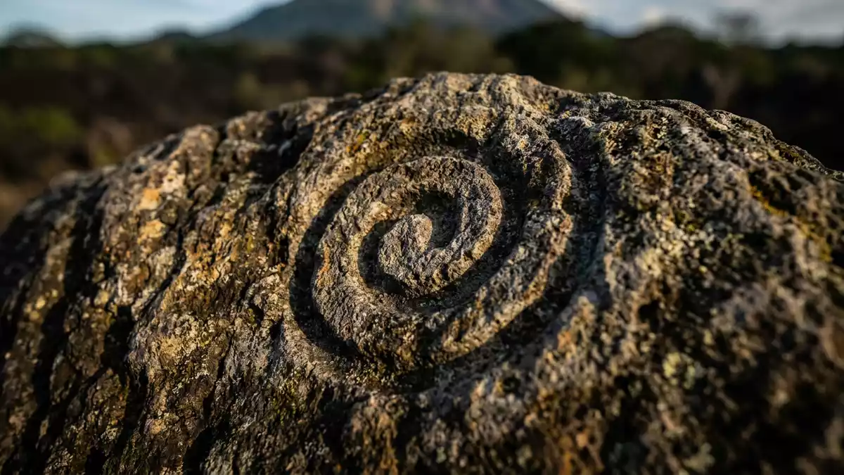
Isla de Ometepe rises from Lake Nicaragua as an island formed by two volcanoes joined by the Istian isthmus. Concepción reaches 1,610 metres, while Maderas rises to 1,394 metres, giving Ometepe its unmistakable two-peak profile.
Isla de Ometepe: an island shaped by two volcanoes
Ometepe lies in south-western Nicaragua, within Lake Nicaragua, also known as Lake Cocibolca. The island’s outline follows the two volcanic mountains and the narrower land between them. The Istian isthmus is made from lava produced by eruptions millions of years ago, linking the northern and southern parts of the island.
Concepción occupies the north-eastern side and remains an active volcano. Its steep cone rises above settlements and agricultural land. Maderas stands to the south-east, with forested slopes and a crater lake near its summit. The contrast between Concepción’s open volcanic form and Maderas’s wooded mass gives the island its defining visual character. Ometepe’s two volcanoes form the central geographic fact of the reserve.
Lake Nicaragua, forests and crater landscapes
Water surrounds Isla de Ometepe on every side. Lake Nicaragua is the largest freshwater lake in Central America, and its broad surface places the volcanic island within a landscape of open water, beaches, wetlands and mountain slopes.
The island’s ecosystems include tropical rainforest, wetlands and fog forest. Spanish cedar and Guarea grandifolia grow among the forest species, while changing elevations provide habitats for birds and other wildlife. Volcán Maderas National Park contains forested terrain associated with species including the yellow-naped parrot and the white-headed capuchin.
The reserve carries the formal designation of a biosphere reserve, with the year of nomination recorded as 2010. Its area is listed as 53,860 hectares. Agriculture, livestock and fishing remain part of life on the island, alongside conservation areas and settlements. Ometepe’s biosphere reserve includes forests, wetlands, crater environments and inhabited land.
Petroglyphs and the cultural landscape of Ometepe
Human history is visible in the rock art and archaeological remains of Isla de Ometepe. Petroglyphs on Maderas preserve mythological imagery dating back about 1,700 years. Their carved surfaces connect the volcanic landscape with the communities that lived around it.
Archaeological records from Maderas include ceramic objects, including religious statues and vessels with distinctive polished surfaces and patterns. These remains form part of the island’s cultural heritage, alongside the churches and settlements of Altagracia and Moyogalpa.
The name Ometepe comes from Nahuatl words associated with two mountains. That meaning describes the island’s physical form with unusual directness: two volcanic peaks rise from freshwater, while the Istian isthmus joins their lower slopes. The Istian isthmus remains the visible link between the island’s two volcanic sections.
Visiting Isla de Ometepe: what travellers from Western Europe should know
- Isla de Ometepe lies in Lake Nicaragua, off the shore near Rivas. Ferries connect the mainland port of San Jorge with island ports including Moyogalpa.
- The island’s terrain rises from lakeside settlements to volcanic slopes. Trails on Concepción and Maderas include steep ground, forest sections and uneven volcanic terrain.
- Moyogalpa and Altagracia are the principal municipalities. Rural roads, farms, beaches and forested areas connect the inhabited parts of the island.
- The official language is Spanish and the currency is the Nicaraguan córdoba.
- Entry requirements depend on your nationality; UK travellers can check the FCDO travel advice at gov.uk/foreign-travel-advice, Irish travellers the Department of Foreign Affairs at ireland.ie.
Searching for Isla de Ometepe on social platforms
These links open searches for Isla de Ometepe on each platform.
Frequently asked questions about Isla de Ometepe
Where is Isla de Ometepe?
Isla de Ometepe is in Lake Nicaragua, in south-western Nicaragua near the mainland town of Rivas. The island belongs to Nicaragua’s Rivas Department.
What can visitors expect on Ometepe?
Visitors encounter ferry ports, rural settlements, agricultural land, beaches, wetlands, forest and volcanic trails. The island combines inhabited landscapes with protected mountain terrain.
What makes Isla de Ometepe distinctive?
Two volcanoes define the island: active Concepción rises to 1,610 metres, while Maderas reaches 1,394 metres. Their lower slopes meet at the Istian isthmus in Lake Nicaragua.


