
Isla de Ometepe, the hourglass island of twin volcanoes
Published on 09/23/2026 at 11:00 | Editorial responsibility: Rafael Müller, Editor-in-Chief AD HOC NEWS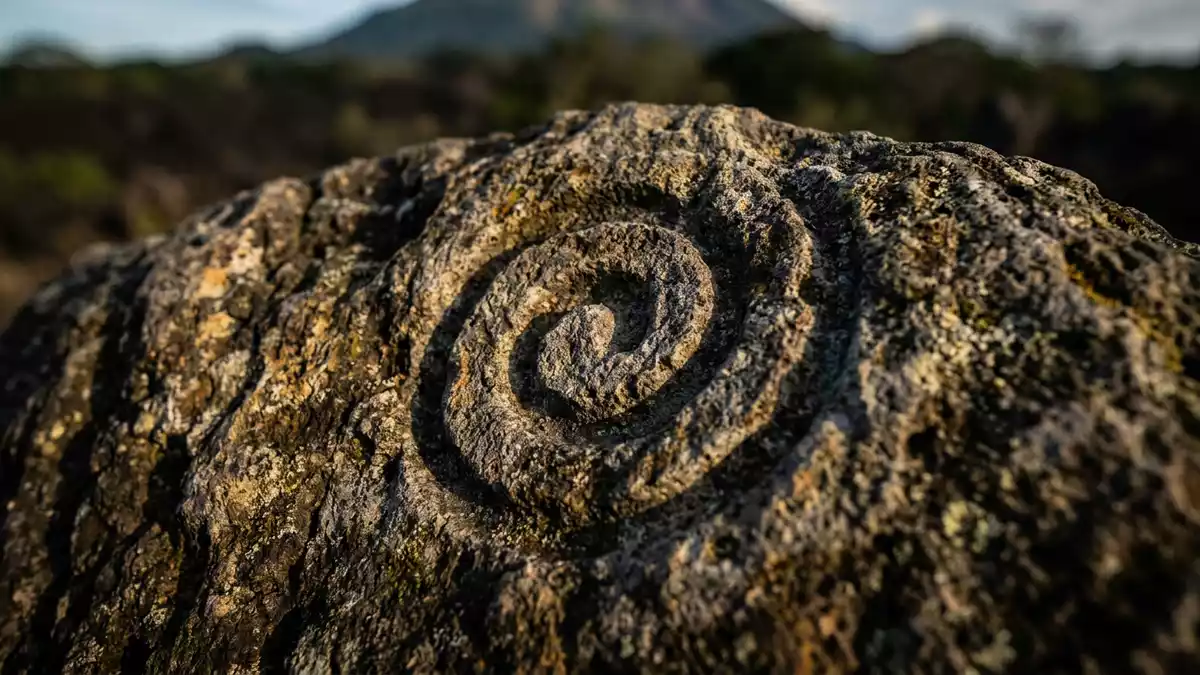
Isla de Ometepe rises from Lake Nicaragua in south-western Nicaragua as two volcanic cones joined by a low strip of land. Concepción and Maderas create an hourglass outline, while forests, wetlands, farms and settlements occupy the shore and the Istian isthmus.
Two volcanoes shape Isla de Ometepe
Concepción forms the northern part of Isla de Ometepe. The active volcano rises to 1,610 metres (5,282 ft), with a steep cone that dominates views across Lake Nicaragua. Maderas occupies the eastern side of the island and reaches 1,394 metres (4,?). Its forested slopes contain a summit crater lake. The two volcanoes are separated by the Istian isthmus, a narrow landform created by lava eruptions millions of years ago. UNESCO’s island profile records the volcanoes, their elevations and the biosphere reserve’s position inside Lake Nicaragua.
The island’s form is visible from the water and from its shoreline settlements. Moyogalpa lies beside Concepción, while Altagracia lies on the north-eastern side. Between the volcanic masses, the low central land carries roads, cultivated plots, wetlands and small communities. The result is a landscape in which a freshwater lake, two volcanoes and working farmland occupy the same geographical frame.
Lake, forest and volcanic ground
Lake Nicaragua surrounds Isla de Ometepe and gives the island its setting as well as its name in many travel descriptions. The lake is the largest freshwater lake in Central America. The shoreline includes beaches, bays, low wetlands and rivers, while higher ground carries tropical rainforest and cloud forest.
The reserve contains Spanish cedar and Guarea grandifolia among its recorded trees. Different elevations support different habitats, from wetland environments near the lake to humid forest on the volcanic slopes. Maderas National Park includes forested terrain and wildlife habitat, while the Concepción Volcano Natural Reserve covers the northern volcanic mass. The island’s protected areas include these volcanic and wetland landscapes.
Water remains a visible part of the island’s geography. Lake Nicaragua surrounds the land, the Istian area links the volcanoes, and the San Juan River traverses the biosphere reserve. Seasonal rainfall, volcanic soils and the island’s elevation produce a landscape used for agriculture, fishing and livestock alongside conservation areas.
Petroglyphs, settlements and a biosphere reserve
Human history on Isla de Ometepe reaches deep into the pre-Columbian past. Petroglyphs on Maderas preserve mythological imagery dating back about 1,700 years. Archaeological records from the area include ceramic objects, religious figures and other pieces connected with the island’s Indigenous cultures.
Spanish colonisation reached Nicaragua in the sixteenth and seventeenth centuries. Isla de Ometepe later remained a lived-in agricultural landscape, with communities including Moyogalpa and Altagracia. Churches, farms, fishing areas and cultivated plots form part of the island’s cultural geography alongside forests and volcanic terrain.
UNESCO added Isla de Ometepe to the World Network of Biosphere Reserves in 2010. The designation covers an area where tropical rainforest, wetlands, agricultural land, settlements and freshwater ecosystems exist within the same reserve. The reserve’s recorded landscape links Maderas, Concepción, the Istian isthmus and Lake Nicaragua.
Visiting Isla de Ometepe: what travellers from Western Europe should know
- Isla de Ometepe lies in Lake Nicaragua, near Rivas. Ferries connect San Jorge on the mainland with Moyogalpa on the island.
- Volcanic terrain defines the island. Trails on Concepción and Maderas involve steep ground, forest paths and substantial elevation gain.
- Moyogalpa and Altagracia are the principal municipalities. Roads, farms, wetlands and shoreline communities occupy the lower land between the volcanoes.
- The official language is Spanish and the currency is the Nicaraguan córdoba.
- Entry requirements depend on your nationality; UK travellers can check the FCDO travel advice at gov.uk/foreign-travel-advice, Irish travellers the Department of Foreign Affairs at ireland.ie.
Searching for Isla de Ometepe on social platforms
These links open searches for Isla de Ometepe on each platform.Frequently asked questions about Isla de Ometepe
Where is Isla de Ometepe?
Isla de Ometepe is in Lake Nicaragua, in south-western Nicaragua near the mainland town of Rivas. The island belongs to the Rivas Department.
What can visitors expect on Isla de Ometepe?
Visitors encounter volcanic landscapes, lake shorelines, tropical forest, wetlands, farms, archaeological traces and settlements such as Moyogalpa and Altagracia.
What makes Isla de Ometepe distinctive?
Two volcanoes, Concepción and Maderas, rise from the same freshwater island and are joined by the Istian isthmus. Their contrasting heights and habitats define the island’s hourglass form.


