
Isla Saona’s wide Caribbean horizon off La Romana
Published on 08/25/2026 at 20:30 | Editorial responsibility: Rafael Müller, Editor-in-Chief AD HOC NEWS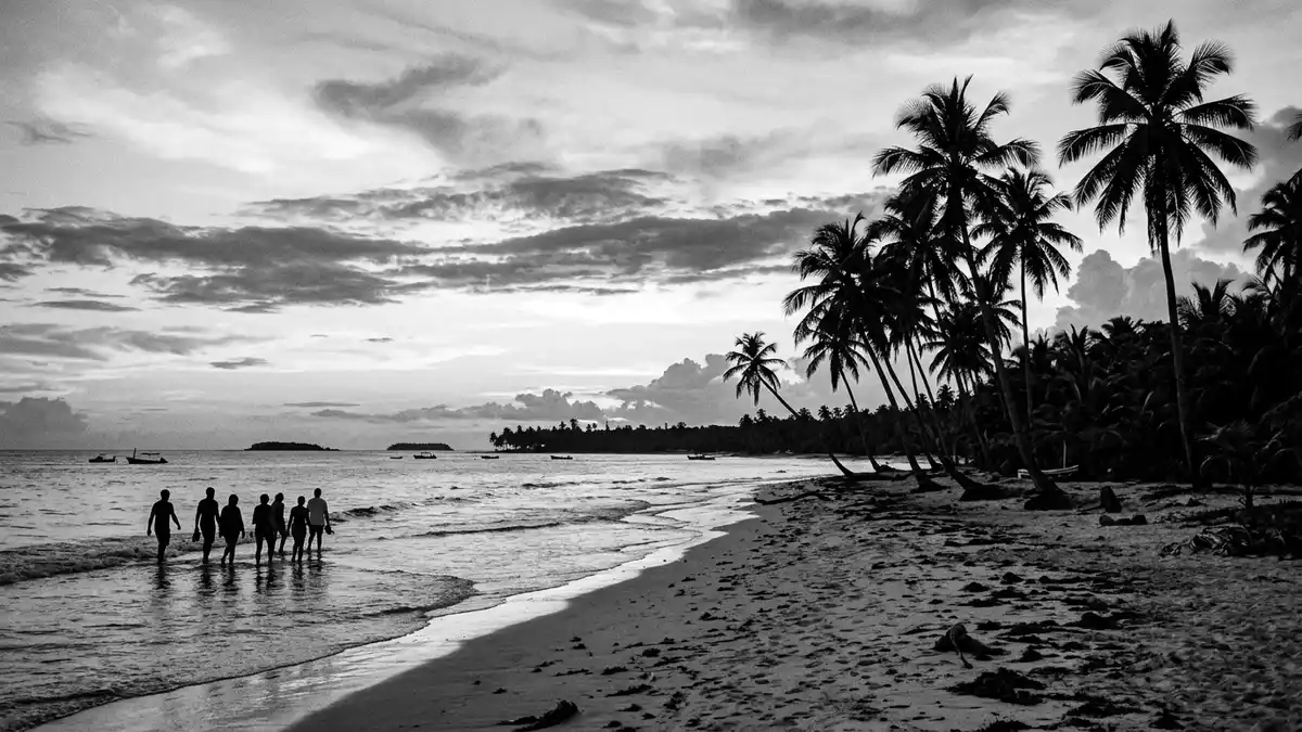
Isla Saona, off the south-eastern tip of the Dominican Republic near La Romana, presents a broad, low island of white sand, palms and shallow sea within Cotubanamá National Park. With its extent of about 110 km² established as protected territory and only small settlements along its shore, the island’s defining impression is a continuous Caribbean horizon where land feels secondary to water and sky.a 110-square-kilometre island
The protected island inside Cotubanamá National Park
Isla Saona forms part of Cotubanamá National Park, a coastal and marine protected area that spans the south-eastern peninsula of Hispaniola and the waters around the island. The park boundary covers the entire island, so Saona sits as a block of protected land and reef within a wider conservation landscape, with mangroves, beaches and forest sharing space with sea grass beds and coral formations.Cotubanamá National Park The designation as a government-protected nature reserve fixes Saona’s status in law, anchoring it as part of the Dominican Republic’s official network of national parks.government-protected nature reserve
Within this framework the island’s coastline is largely free of large-scale construction, and the beaches remain backed mainly by coconut palms and low vegetation rather than resort buildings.protected site spanning 110km2 The park also includes nearby Isla Catalinita and areas of mainland coast, but Saona itself stands out through its size among Dominican islands and its long alignment facing the Caribbean Sea.covers the entire island of Saona
Landscape of long beaches, shallow pools and small communities
The island’s southern and western sides are lined with extended beaches of pale sand, where palm trees reach out over water that stays relatively shallow for a considerable distance. Offshore sandbars and submerged shelves form wide natural pools, a characteristic feature of excursions around Isla Saona, while further out the sea deepens towards coral reefs that attract snorkellers.long palm-lined beaches On the northern shore the coastline becomes more irregular, with areas of mangrove and less continuous stretches of sand.more rugged northern shore
Two permanent settlements anchor human life on Isla Saona: Mano Juan, a fishing village on the coast, and a naval base at Catuano.two permanent settlements Mano Juan consists of modest houses set near the beach, with small boats drawn up along the shore, while Catuano occupies a strategic position by the channel separating Saona from the mainland. Away from these points the island remains largely undeveloped, and paths lead from the coast into low forest and scrub where the protected status supports endemic Caribbean species.provides asylum to endemic species
Saona’s position off La Romana and Bayahíbe
Isla Saona lies off the south-eastern tip of the Dominican Republic, across the Catuano channel from the mainland coast of La Altagracia province, yet administratively linked with La Romana.belongs to the province La Romana The island sits roughly south of Bayahíbe and Boca de Yuma, forming the seaward edge of the national park and looking out over open Caribbean water.lies offshore of the southeastern tip Its separation from the mainland by water, with no bridge, means that every journey to Saona is by boat.
Day trips and other organised excursions depart mainly from Bayahíbe, a fishing village near La Romana, and from resort zones in La Romana and Punta Cana, crossing the channel towards Saona and pausing at shallow sandbars along the way.main pier is Bayahíbe Boats land at beach areas along the island’s coast, where simple facilities such as shaded areas, picnic tables and basic services support visitors without changing the overall character of a largely undeveloped shore.comfortable facilities for visitors
Visiting Isla Saona: what travellers from Western Europe should know
- Isla Saona lies off the south-eastern coast of the Dominican Republic, opposite Bayahíbe and Boca de Yuma, and is reached by boat from Bayahíbe or other nearby ports in La Romana and Punta Cana.
- Access to beach areas on the island usually involves boarding and disembarking from boats directly onto sand or shallow water, so walking surfaces vary between boat decks, sand and uneven shore.
- The island is part of Cotubanamá National Park, so visits combine sea travel with time on a low-lying tropical island where shade comes mainly from coconut palms and other vegetation.
- Spanish is the official language of the Dominican Republic and the currency is the Dominican peso.
- Entry requirements depend on your nationality; UK travellers can check the FCDO travel advice at gov.uk/foreign-travel-advice, Irish travellers the Department of Foreign Affairs at ireland.ie.
Searching for Isla Saona on social platforms
These links open searches for Isla Saona on each platform.
Frequently asked questions about Isla Saona
Where is Isla Saona in relation to La Romana?
Isla Saona lies off the south-eastern coast of the Dominican Republic, opposite Bayahíbe, and belongs administratively to the province of La Romana.
What kind of landscape can visitors expect on Isla Saona?
Visitors encounter long white-sand beaches lined with palm trees, shallow natural pools over sandbars, mangrove areas and low forest within a protected island setting.
What makes Isla Saona distinctive among Dominican islands?
Its combination of considerable size, full inclusion within Cotubanamá National Park and largely undeveloped shoreline gives Isla Saona an extended, protected Caribbean horizon uncommon among nearby islands.


