
Kenting Guojia Gongyuan and Taiwan’s coral coast
Published on 09/24/2026 at 03:27 | Editorial responsibility: Rafael Müller, Editor-in-Chief AD HOC NEWS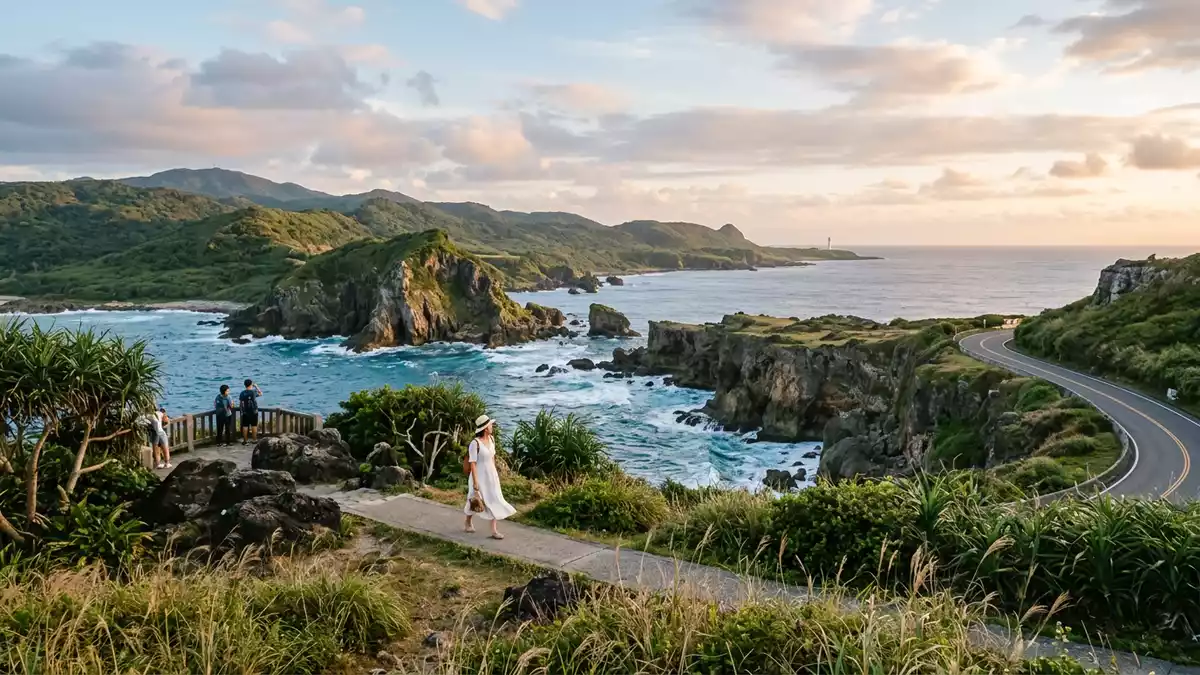
Kenting Guojia Gongyuan stretches across the Hengchun Peninsula at the southern tip of Pingtung County, Taiwan. Its landscape joins coral limestone, tropical vegetation, open coast and marine waters within one protected area.
Kenting Guojia Gongyuan on the Hengchun Peninsula
The park occupies the southern end of Taiwan’s main island, where the Taiwan Strait lies to the west and the Pacific Ocean reaches the eastern coast. The Bashi Channel borders the peninsula’s southern end, giving Kenting a maritime setting on three sides.
The protected area includes coastal land, inland hills, forest, grassland, lakes, beaches, sand dunes and coral reefs. Rural settlements and agricultural land also form part of the peninsula’s inhabited landscape. This combination gives the park a broader character than a forest reserve or a single coastal viewpoint.
Kenting Guojia Gongyuan was established in September 1982, when Taiwan’s national park system took shape under the National Park Law. The park headquarters began operating in 1984, and the area became Taiwan’s first national park within the modern system. Kenting’s establishment date is recorded alongside its land and marine extent.
Coral limestone above a tropical sea
Coral limestone is the dominant geological material across much of the peninsula. Ancient reef material was raised above the sea and weathered into terraces, low hills, cliffs and broken rock surfaces. The result is a landscape shaped by both marine origins and tropical erosion.
The uplifted coral terrain appears in inland forest as well as along the shore. At Kenting National Forest Recreation Area, limestone landforms stand among monsoon rainforest and tropical plant communities. The site’s geological character connects the forest paths with the reefs and coastal cliffs beyond them.
The park’s marine environment contains coral reefs and clear coastal waters. The Kuroshio Current passes through the surrounding sea, with water temperatures recorded between 22°C and 29°C. Coral communities, rocky shores and sandy beaches create distinct habitats along the peninsula.
The forest landscape includes tropical trees, vines, palms and other plants adapted to warm, humid conditions. Grassland and open coastal vegetation occupy areas beyond the denser woodland. The uplifted coral reef forest at the forest recreation area forms a particularly clear meeting point between geology and vegetation.
Headlands, lighthouses and the park’s marine edge
Eluanbi Lighthouse marks the southern tip of the Hengchun Peninsula. The white tower rises above coral rock near the meeting of the peninsula’s coastal waters, with routes and viewpoints extending through the surrounding parkland.
Other named landscapes include Longpan Park, Maobitou, Chuanfan Rock, South Bay and the Hengchun Old Town area beyond the park’s coastal scenery. Their forms differ: grassy uplands, sea-facing cliffs, beaches, rocky projections and settled streets all appear within the wider southern peninsula.
Longpan’s open ground lies above the Pacific coast, where grassland reaches the edge of raised coral terrain. Maobitou presents another coastal rock formation, while Chuanfan Rock stands offshore as a distinct natural landmark. Each site shows a different relationship between limestone and sea.
Kenting also carries a human history connected with maritime settlement and Austronesian culture. People lived around the peninsula’s mountains and waters thousands of years ago. The protected landscape therefore contains ecological, geological and cultural layers within the same southern setting.
The park covers roughly 32,570 hectares, including land and marine areas. Its boundaries extend across Hengchun Township, Checheng Township and Manzhou Township in Pingtung County. The Kenting National Park plan belongs to Taiwan’s national conservation framework.
Visiting Kenting Guojia Gongyuan: what travellers from Western Europe should know
- Kenting Guojia Gongyuan lies on the Hengchun Peninsula in Pingtung County. Road access connects the park with Hengchun and the coastal settlements, while buses and taxis serve the peninsula.
- The terrain changes between beaches, exposed coral limestone, forest paths, grassland and coastal cliffs. Walks can include uneven rock, stairs, sun-exposed ground and steep edges near the sea.
- The southern tip contains Eluanbi Lighthouse and coastal paths. Longpan Park and Maobitou present open viewpoints above different sides of the peninsula.
- The official language is Mandarin Chinese and the currency is the New Taiwan dollar.
- Entry requirements depend on your nationality; UK travellers can check the FCDO travel advice at gov.uk/foreign-travel-advice, Irish travellers the Department of Foreign Affairs at ireland.ie.
Searching for Kenting Guojia Gongyuan on social platforms
These links open searches for Kenting Guojia Gongyuan on each platform.
Frequently asked questions about Kenting Guojia Gongyuan
Where is Kenting Guojia Gongyuan?
Kenting Guojia Gongyuan occupies the Hengchun Peninsula in southern Pingtung County, Taiwan. Its land and marine areas reach the Taiwan Strait, the Pacific Ocean and the Bashi Channel.
What can visitors expect across the park?
The park contains beaches, coral reefs, forest, grassland, limestone hills, coastal cliffs, rural land and named viewpoints. Eluanbi Lighthouse, Longpan Park and Maobitou are among its recognisable places.
What makes Kenting Guojia Gongyuan distinctive?
Its landscape combines uplifted coral limestone with tropical forest and marine habitats. The park’s national conservation area includes both terrestrial and sea environments across the southern peninsula.


