
Kinderdijk and the windmills that hold a landscape together
Published on 09/23/2026 at 11:25 | Editorial responsibility: Rafael Müller, Editor-in-Chief AD HOC NEWS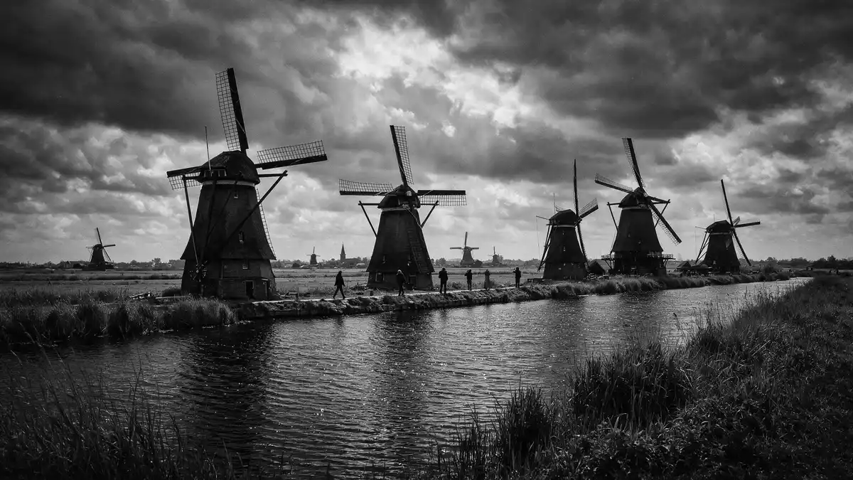
Kinderdijk is a low-lying landscape where nineteen windmills stand beside canals, dikes and pumping stations. Their vertical sails rise from a carefully organised network of water, land and embankments in South Holland. The windmills are not isolated monuments; together, they form a working cultural landscape associated with Dutch water management.
Kinderdijk: nineteen windmills in a water landscape
The windmills stand across the Alblasserwaard, a polder landscape near the rivers Lek and Noord. Water channels divide the fields, while dikes and embankments mark the edges of land kept above surrounding water levels. The arrangement is horizontal in the fields and canals, then vertical where the sails and wooden bodies rise above them. The UNESCO landscape includes drainage mills, pumping stations, discharge sluices, dikes and water-board buildings.
The group contains different types of mill and several historic water-management installations. The eight Nederwaard windmills date from 1738, while the eight Overwaard windmills date from 1740. The Blokweer mill belongs to an older tradition and has a form that differs from the larger group around it.
From medieval water boards to UNESCO heritage
Water management in the Alblasserwaard reaches back to the Middle Ages. In 1277, Floris V, Count of Holland, established a water board in the region. This created an organised framework for maintaining dikes and managing drainage across separate communities.
Wind power became part of this system through mills that lifted water from lower polders into higher channels. The nineteenth-century landscape visible at Kinderdijk therefore contains several layers of engineering: medieval administrative organisation, drainage channels, embankments, windmills and pumping technology. The history of Kinderdijk records more than seven centuries of organised water management.
In 1997, the Mill Network at Kinderdijk-Elshout entered the UNESCO World Heritage List. The designation covers the relationship between buildings, machinery and landscape, not merely the surviving windmills. Kinderdijk is therefore read as a complete water-management system preserved across a broad rural setting.
Inside the mills and along the polder paths
Kinderdijk can be explored through paths beside the waterways, with the windmills arranged across the landscape rather than gathered in a single square. The canals reflect the mills, while bridges and embankments connect the separate parts of the site. The route passes working elements of drainage alongside structures preserved for their historical value.
Several mills have interiors arranged as museums. The Nederwaard Museum Mill presents the machinery and domestic spaces associated with mill life. The Blokweer Museum Mill represents an older mill tradition and includes a small farm setting. Other windmills remain visible from outside, forming a long sequence across the polder.
The windmills and pumping stations show how separate mechanical elements fitted into the wider drainage network. Their sails, brickwork, timber, thatched roofs and machinery give the landscape architectural variety, while the canals and dikes provide its continuous framework.
Visiting Kinderdijk: what travellers from Western Europe should know
- Kinderdijk lies in South Holland, near the villages of Nieuw-Lekkerland and Alblasserdam. Public transport connections include Waterbus services from Rotterdam or Dordrecht and bus line 489 from Rotterdam Kralingse Zoom.
- The site is a polder landscape with canals, bridges, embankments and paths. Walking takes place beside open water and across changing ground levels.
- Water transport reaches the area through the Waterbus network. The nearest river connections relate Kinderdijk to the wider Rotterdam and Dordrecht region.
- The official language is Dutch and the currency is the euro.
Searching for Kinderdijk on social platforms
These links open searches for Kinderdijk on each platform.
Frequently asked questions about Kinderdijk
Where is Kinderdijk?
Kinderdijk is in South Holland, near the rivers Lek and Noord. The village lies in the Alblasserwaard polder landscape, east of Rotterdam.
What can visitors expect at Kinderdijk?
Visitors find canals, dikes, bridges, paths, windmills, pumping stations and museum interiors. The landscape is experienced on foot and through its connected water-management features.
What makes Kinderdijk distinctive?
Kinderdijk brings nineteen historic windmills together with the wider drainage system they belong to. Its UNESCO designation recognises the complete relationship between machinery, buildings, water and land.


