
Lac Retba’s pink waters and salt plains near Dakar
Published on 09/21/2026 at 22:25 | Editorial responsibility: Rafael Müller, Editor-in-Chief AD HOC NEWS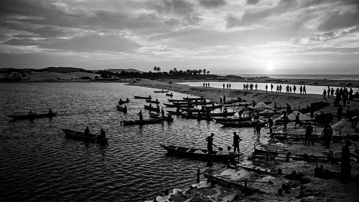
Lac Retba, on Senegal’s Cap Vert Peninsula north-east of Dakar, is a shallow hypersaline lake where pink water, pale salt crusts and coastal dunes share the same compact basin. Set just inland from the Atlantic, the lake covers around 3 km² and reaches only about 3 m in depth, which gives it the character of a broad, low bowl of water framed by sand and salt along the shore in the Dakar Region.
Pink water in a shallow coastal basin
Lac Retba is a small coastal lagoon on the Cap Vert Peninsula in western Senegal, separated from the Atlantic Ocean by a corridor of dunes that forms a sandy barrier between the basin and the surf outside.located on the edge of Cap Vert Peninsula The lake lies north-east of Dakar in the Dakar Region and sits within the department of Rufisque, close to low-lying settlements and open land rather than dense city streets.forms part of the Dakar Region
The basin itself is modest in extent, with sources giving figures of about 3 km² for its surface area and maximum depths around 3 m across much of its centre.surface area and depth The lake’s waters carry a high salt content, with salinity values described as reaching levels comparable with some of the world’s saltiest lakes, which reinforces its classification as a hypersaline water body.one of the world’s saltiest lakes The pink colour that gives Lac Retba its character is linked in published studies and descriptions to microscopic algae such as Dunaliella salina, which thrive in saline conditions and can tint the water surface.
Salt plains, dunes and a working landscape
Along the margins of Lac Retba, the water meets pale banks where salt accumulates and forms crusts and shallow mounds, giving stretches of the shoreline a layered appearance of white and light grey against the coloured water.pale salt plains and Atlantic dunes In places the basin edge blends into flat salt fields where harvested material is stacked or spread, and beyond these, sandy slopes lead up towards the coastal dune belt that separates the lake from the Atlantic shore.
The wider setting combines lagoon, dunes and open ground in a continuous band along this section of Senegal’s Grande Côte, with Lac Retba occupying a depression whose shoreline lies several metres below sea level in some descriptions.a depression with a shoreline below sea level The lake has been used for salt production for decades, and accounts of the place describe workers entering the water to collect salt by hand before bringing it to the shore for drying and transport.salt collected and used to preserve fish This working character adds an industrial layer to the landscape, sitting alongside tourism and day visits from Dakar.
Lac Retba as a destination near Dakar
Lac Retba has long been described as a destination in the Dakar Region whose draw lies in its coloured water, its high salinity and the juxtaposition of lake, salt flats and ocean dunes in a compact area north-east of the capital.lies just north of the Cap Vert Peninsula of Senegal, northeast of Dakar The lake is close enough to Dakar for day trips and sits within reach of coastal roads linking the city with other parts of western Senegal.shallow basin meets dunes and salt flats
Descriptions of visits emphasise the contrast between the coloured water surface and the pale salt along the shore, as well as the proximity of Atlantic beaches and dunes that form a continuous coastal strip with the lake just inland. Travellers encounter a mix of natural forms and human activity, with boats, piles of salt and informal access points where tracks from the surrounding land reach the basin edge.
Visiting Lac Retba: what travellers from Western Europe should know
- Lac Retba lies north-east of Dakar on the Cap Vert Peninsula in western Senegal and is reached overland from the capital and other coastal towns by road.
- The terrain around the lake includes sandy banks, salt crusts and low dunes, with informal tracks rather than paved promenades along much of the shoreline.
- The wider setting combines Lac Retba with Atlantic dunes and beaches, so lake visits often take place in a landscape of sand, open ground and low vegetation.
- The official language is French and the currency is the West African CFA franc.
- Entry requirements depend on your nationality; UK travellers can check the FCDO travel advice at gov.uk/foreign-travel-advice, Irish travellers the Department of Foreign Affairs at ireland.ie.
Searching for Lac Retba on social platforms
These links open searches for Lac Retba on each platform.
Frequently asked questions about Lac Retba
Where is Lac Retba located in relation to Dakar?
Lac Retba lies on the Cap Vert Peninsula in western Senegal, north-east of Dakar and just inland from the Atlantic coast behind a belt of dunes.
What should visitors expect when they reach the lake?
Visitors encounter a shallow basin of pink-tinged water bordered by sandy banks, salt crusts and low dunes, with tracks and informal access points along parts of the shore.
What makes Lac Retba distinctive among lakes in the Dakar Region?
The combination of hypersaline pink water, active salt harvesting and the immediate presence of coastal dunes and Atlantic beaches makes Lac Retba distinctive in the Dakar Region.


