
Lago de Atitlan and Panajachel in a volcanic highland basin
Published on 09/19/2026 at 12:56 | Editorial responsibility: Rafael Müller, Editor-in-Chief AD HOC NEWS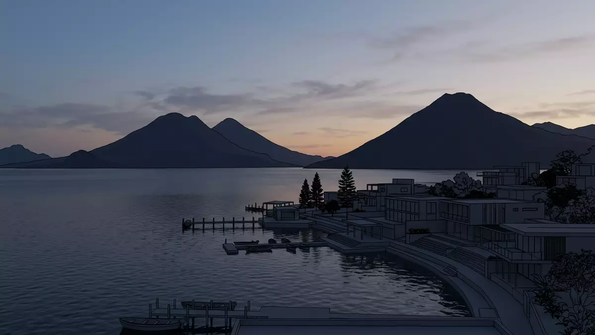
Lago de Atitlan in Guatemala’s highlands is a volcanic lake framed by steep slopes and three named volcanoes, with the town of Panajachel on its north-eastern shore. Formed within the Atitlan III caldera during the Los Chocoyos super-eruption in the Late Pleistocene, the basin later filled with water to create one of Central America’s deepest lakes.Lake Atitlan facts
A caldera lake ringed by volcanoes
Lago de Atitlan sits inside a volcanic caldera in the Guatemalan Highlands, part of the Sierra Madre range in the Sololá Department of south-western Guatemala.large natural lake in the Guatemalan Highlands The lake occupies the Atitlan III caldera, a depression that formed roughly 84,000 years ago when the Los Chocoyos eruption emptied a magma chamber and the overlying ground collapsed.Los Chocoyos super-eruption Over millennia, rainwater and groundwater collected within the basin, creating an enclosed lake without a visible outlet.
The water surface lies at about 1,562 m (5,125 ft) above sea level, and the basin reaches a maximum depth of around 340 m (1,115 ft), making Lago de Atitlan the deepest lake in Central America.deepest lake in Central America Three stratovolcanoes rise above its southern shore: Volcán Atitlán, Volcán Tolimán and Volcán San Pedro, each forming a prominent cone that shapes the skyline.three major volcanoes Their slopes drop towards the lake, meeting the water at steep angles that emphasise the basin’s volcanic origins.
Panajachel and the lakeside towns
Panajachel is a town on an alluvial delta along Lago de Atitlan’s north-eastern shore, in the department of Sololá.Panajachel on the northeastern shore The delta formed where the Panajachel River spreads out as it reaches the lake, creating relatively level ground between the water and the rising slopes behind the town.alluvial delta formed by the Panajachel River From Panajachel, the lake opens south-westwards, with views across the water to the volcanoes on the far shore and to smaller settlements along the edges.
The shores around Lago de Atitlan are lined with Maya towns and villages, many of which retain distinct identities tied to language and local traditions.surrounded by Maya towns Settlements cluster where the terrain permits construction, on deltas and gentler slopes, while the steep escarpments around much of the basin remain sparsely built.deep escarpments surround it Boats cross the water between these communities, linking Panajachel with towns on the southern and western shores.
Geology and the volcanic landscape
The Lake Atitlan region has a long record of volcanic activity, with several cycles of stratovolcano growth, major silicic eruptions and caldera formation described in geological studies.geology of the Lake Atitlán region The most recent major caldera-forming event created the Atitlan III basin, now partly filled by Lago de Atitlan. Subsequent eruptions built the three younger volcanoes on the caldera’s southern edge: San Pedro, Tolimán and Atitlán.three post-caldera volcanoes
Volcán Atitlán, the youngest of the group, stands on the southern rim of the caldera and is considered an active stratovolcano.Atitlán Volcano on the southern rim Volcán Tolimán and Volcán San Pedro rise nearby, forming a chain of high cones above the lake’s southern and western margins.stratovolcanoes and caldera Together, the caldera walls, escarpments and volcanoes create a closed volcanic basin, with Lago de Atitlan occupying the central depression and smaller deltas, like the one beneath Panajachel, extending into the water from the north.
Visiting Lago de Atitlan: what travellers from Western Europe should know
- Lago de Atitlan lies in south-western Guatemala, in the Sololá Department, with Panajachel on its north-eastern shore reached across the Guatemalan Highlands.
Panajachel is connected to other lakeside towns by boat services that cross the volcanic basin from the north-eastern shore towards the southern and western settlements. - The basin is surrounded by steep escarpments and volcanic slopes, so reaching viewpoints or hilltop paths above the lake involves gradients and extended stairways rather than level ground.
- Volcán Atitlán, Volcán Tolimán and Volcán San Pedro rise above the southern and western shores, and walks near these volcanoes take place at altitude along mountain terrain shaped by the caldera.
- Lago de Atitlan lies in Guatemala, where the official language is Spanish and the currency is the quetzal.
- Entry requirements depend on your nationality; UK travellers can check the FCDO travel advice at gov.uk/foreign-travel-advice, Irish travellers the Department of Foreign Affairs at ireland.ie.
Searching for Lago de Atitlan on social platforms
These links open searches for Lago de Atitlan on each platform.
Frequently asked questions about Lago de Atitlan
Where is Lago de Atitlan?
Lago de Atitlan lies in the Sololá Department of south-western Guatemala, in the Guatemalan Highlands, with Panajachel on its north-eastern shore.
What should travellers expect on a visit?
Travellers encounter a deep volcanic lake enclosed by steep slopes, Maya lakeside towns, and views towards three stratovolcanoes rising above the southern and western shores.
What makes Lago de Atitlan distinctive?
Lago de Atitlan occupies a volcanic caldera formed by the Los Chocoyos super-eruption and is ringed by the Atitlán, Tolimán and San Pedro volcanoes, creating a pronounced volcanic basin.


