
Lago di Como: a Y-shaped lake between Alps and elegant villas
Published on 09/19/2026 at 07:28 | Editorial responsibility: Rafael Müller, Editor-in-Chief AD HOC NEWS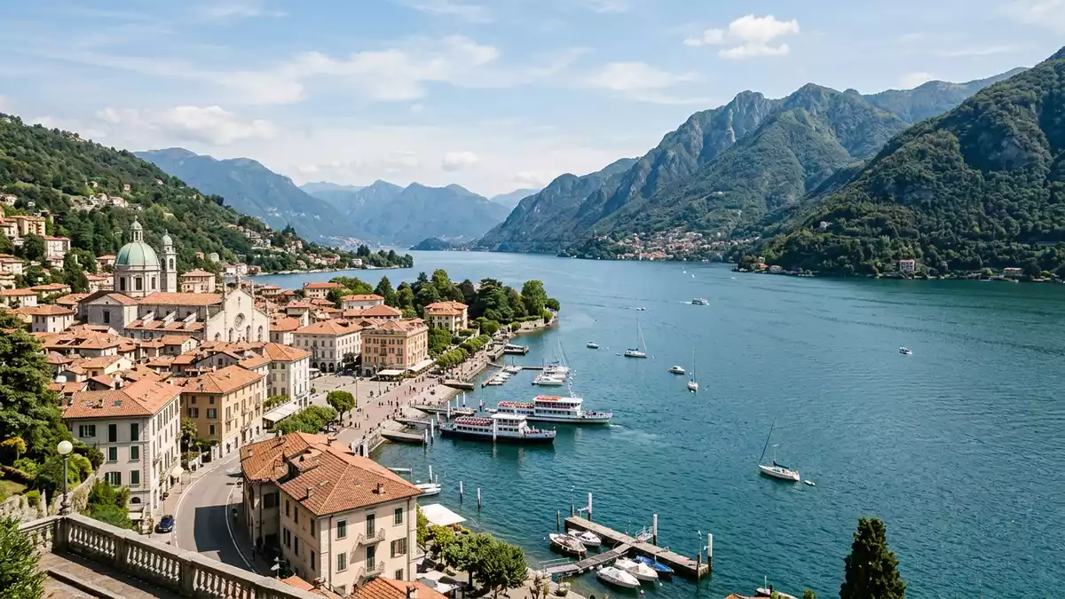
Lago di Como, known in English as Lake Como, is a glacial lake in northern Italy framed by steep mountains and an intricate, Y-shaped shoreline. Set in Lombardy, it lies north of Milan and stretches between the provinces of Como and Lecco, with the city of Como anchoring its south-western corner.
The shape of Lago di Como and its alpine setting
Lago di Como takes the form of a reversed Y, with three long branches of water meeting at Bellagio where the central headland splits the basin. The lake occupies a deep depression carved by ancient ice, and is classed as a lake of glacial origin in the Italian Lake District, part of the broader pre?Alpine landscape of Lombardy.glacial origin in Lombardy Mountains in limestone and granite rise directly from the shoreline, especially along the eastern arm towards Lecco, giving many stretches of coast a dramatic, enclosed character.limestone and granite mountains
In plan, the western arm runs north from Como towards Cernobbio and Menaggio, the eastern arm leads from Lecco northwards, and the central branch extends towards Colico near the northern end. The Italian name Lario, used alongside Lago di Como, recalls the Latin Larius Lacus and appears in historical references across the region.Lario from Larius Lacus The lake’s surface covers around 146 km² (56 sq mi), making it the third-largest lake in Italy by area, after Garda and Maggiore, while its basin plunges well below sea level to a depth of over 400 m (around 1,300 ft).146 km² and great depth
Historic lakeside towns and grand villas
Settlements cluster along the shores of Lago di Como, often on narrow terraces between water and mountain. Como stands at the south-west end of the lake, a historic city with a waterfront promenade and streets leading back from the harbour. Further north on the western shore, Cernobbio and Moltrasio face towards the central basin, while Menaggio occupies a natural bay opposite Bellagio.
Bellagio itself sits on the tip of the headland where the three arms meet, giving views along all branches of the lake. On the eastern shore, Varenna and Lecco face steep slopes, with railway and road routes following the water’s edge. Many villas and gardens line these settlements, reflecting centuries of lakeside residence by Lombard merchants, Italian aristocratic families and later visitors drawn to the scenery. Some of the most documented historic villas include Villa Carlotta near Tremezzo, known for its landscaped gardens and art collections, and Villa del Balbianello south of Lenno on a wooded promontory overlooking the central basin.Bellagio, Tremezzo and Lennotowns such as Bellagio and Varenna
Water, movement and views across the lake
Lago di Como is fed and drained by a network of rivers, with the Adda entering near Colico and leaving again near Lecco, tying the lake into the wider Alpine catchment. The long, branching shape creates multiple crossings, and boat services link many of the main settlements, turning the water into an everyday route as well as a vantage point for views of villages, terraced slopes and peaks.lake area and hydrology From Como’s waterfront the western arm stretches between headlands towards Cernobbio, while crossings between Bellagio, Menaggio and Varenna reveal the lake’s full width.
Along the shore, promenades, small harbours and stone quays mark transitions between town and water, often with rows of plane trees or other planting separating road from lake. In many places the mountains rise almost directly behind the built strip, so a short walk inland leads quickly from waterfront to steep lanes and hillside paths. Travellers experience Lago di Como both from the surface of the water and from terraces high above it, where viewpoints look down on the junction of the three arms and the surrounding Alpine foothills.
Visiting Lago di Como: what travellers from Western Europe should know
- Lago di Como lies in Lombardy in northern Italy, with Como at the south-west end of the western arm and Lecco at the end of the eastern arm; rail links connect both cities with Milan.
- The terrain around the lake is steep, with towns often built on narrow ledges between water and mountain, so streets and paths frequently involve steps and short but pronounced gradients.
- Roads and railway lines follow the main arms of the lake, particularly between Como and Lecco and along the eastern shore towards the northern basin, with tunnels and bridges marking sections where the slopes descend directly to the water.
- The official language is Italian and the currency is the euro.
Searching for Lago di Como on social platforms
These links open searches for Lago di Como on each platform.Frequently asked questions about Lago di Como
Where is Lago di Como and how is it shaped?
Lago di Como is in Lombardy in northern Italy, north of Milan, and its basin has a distinctive reversed Y shape with three long branches of water.
What can travellers expect when visiting Lago di Como?
Travellers encounter lakeside towns on narrow terraces between steep mountains and water, linked by roads, railways and boat services that follow the three arms.
What makes Lago di Como distinctive among Italian lakes?
Lago di Como combines great depth and branching form with an alpine setting, historic towns such as Como and Bellagio, and a concentration of villas and gardens along its shores.


