
Mount Rainier National Park and its living crown of ice
Published on 09/05/2026 at 19:58 | Editorial responsibility: Rafael Müller, Editor-in-Chief AD HOC NEWS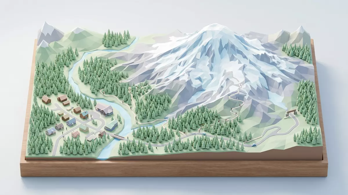
Mount Rainier National Park in Washington State wraps the volcano Mount Rainier in a broad protected landscape of forested valleys, high ridges and a conspicuous crown of ice. Established in 1899 as the fifth national park in the United States, it lies in Pierce and Lewis counties and is reached from the small community of Ashford on the mountain’s western side.Mount Rainier National Park
The glacier?clad volcano at the park’s centre
The core of Mount Rainier National Park is the stratovolcano Mount Rainier, rising to more than 4,390 m (14,410 ft) at Columbia Crest on its summit. The mountain stands on the western slope of the Cascade Range, south?south?east of Seattle, and dominates the surrounding landscape with its massive, ice?covered dome.Geography of Mount Rainier National Park The park’s terrain ranges from deep river valleys at around 520 m (1,710 ft) near the Carbon River and Ohanapecosh entrances to high alpine slopes far above the treeline.
Mount Rainier carries one of the largest single?peak glacial systems in the contiguous United States, with dozens of named glaciers draped around the summit cone and flowing down broad flanks into cirques and valleys.Mount Rainier geodiversity atlas These ice bodies feed rivers that cut across the park and have carved horns, ridges and U?shaped valleys, leaving a landscape where bare volcanic rock, permanent snow and dense forest meet within relatively short horizontal distances.
A protected landscape since the nineteenth century
Mount Rainier National Park was established on 2 March 1899 by an act of the United States Congress signed by President William McKinley, creating a large reserve around the mountain to conserve its scenery and scientific value.Legislation creating Mount Rainier National Park At the time it became the fifth national park in the country, following Yellowstone, Yosemite, Sequoia and General Grant National Parks. The designation set aside hundreds of square miles of Cascade Range landscape, including glaciers, subalpine meadows and coniferous forests.
Within the park boundary, the land spans more than 950 km² (around 365 square miles), taking in high ridges, plateaus and multiple river systems that radiate away from Mount Rainier.Extent of the park Over the twentieth century, roads and trails were laid out across this terrain, providing access to areas such as Paradise and Sunrise, while still leaving large tracts of backcountry where the mountain’s volcanic rock and glacial deposits remain largely undeveloped. The park’s status helps conserve a cross?section of Cascade Range ecosystems and geomorphological features around the volcano.
Glaciers, rivers and high meadows
The glacial system of Mount Rainier National Park covers a significant proportion of the upper mountain, with the combined area of the glaciers occupying several tens of square kilometres of ice and perennial snow.Glacier atlas of Mount Rainier Among the named glaciers are Emmons on the north?east side, Carbon under the high headwall known as Willis Wall, Nisqually above its river of the same name, and large ice bodies such as Winthrop and Tahoma. Some glaciers descend in long tongues from near the summit, while others originate in cirques on the mountain’s flanks.
Below the permanent snow and ice, Mount Rainier National Park is cut by rivers that carry sediment from the glaciers and snowfields into lower valleys, giving some streams a milky colour during warmer months. At intermediate elevations, glacially carved basins hold subalpine meadows where grasses and flowering plants grow between patches of rock and remnant snowfields. Lower down, extensive coniferous forests cover slopes and valley floors, rooted in glacial till and volcanic soils and broken by talus slopes and cliffs where bedrock lies exposed.Geohazards and landforms
Visiting Mount Rainier National Park: what travellers from Western Europe should know
- Mount Rainier National Park lies in west?central Washington State on the western slope of the Cascade Range, with Ashford serving as a gateway community along the main road towards the park entrance.
The closest major city is Seattle to the north?west. - The terrain inside the park ranges from forested river valleys to steep mountain slopes and high ridges, with substantial elevation gain on many trails and viewpoints.
Paths, bridges and stairways can involve sustained gradients and uneven surfaces. - The official language is English and the currency is the United States dollar.
- Entry requirements depend on your nationality; UK travellers can check the FCDO travel advice at gov.uk/foreign-travel-advice, Irish travellers the Department of Foreign Affairs at ireland.ie.
Searching for Mount Rainier National Park on social platforms
These links open searches for Mount Rainier National Park on each platform.
Frequently asked questions about Mount Rainier National Park
Where is Mount Rainier National Park located?
Mount Rainier National Park is in west?central Washington State, in Pierce and Lewis counties, on the western slope of the Cascade Range, south?south?east of Seattle.
What kind of landscape should visitors expect?
Visitors encounter a volcanic mountain wrapped in glaciers, rivers and subalpine meadows, with extensive coniferous forests in the lower valleys and steep, rocky slopes higher up.
What makes Mount Rainier National Park distinctive among US national parks?
The park centres on a single high stratovolcano whose summit and flanks carry one of the largest single?peak glacial systems in the contiguous United States, feeding multiple river valleys in a compact area.


