
Mu Ko Similan: granite islands rising from the Andaman Sea
Published on 09/24/2026 at 03:11 | Editorial responsibility: Rafael Müller, Editor-in-Chief AD HOC NEWS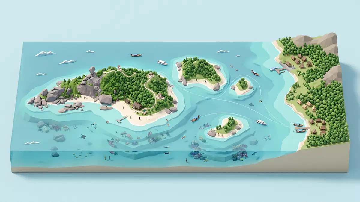
Mu Ko Similan is an archipelago of granite islands in the Andaman Sea, off Phang Nga Province in southern Thailand. Rounded boulders, pale beaches and reef-fringed water form a landscape where land and sea meet in sharply defined layers.
Granite islands in an open sea
Mu Ko Similan National Park lies offshore from Thailand’s Andaman coast. Its islands extend in a north–south chain, with the mainland shoreline of Phang Nga far to the east and the open Andaman Sea surrounding the park.
The group associated with the Similan Islands contains nine principal islands. Their names include Ko Bon, Ko Bangu, Ko Similan, Ko Payu, Ko Ha, Ko Miang, Ko Payan, Ko Payang and Ko Huyong. The word “Similan” comes from a Yawi or Malay term meaning nine, a reference to the original island group.
The national park also includes nearby islands beyond the original nine. The wider protected area covers approximately 140 square kilometres, including about 26 square kilometres of land. Its offshore setting gives the park a distinctly marine character, while steep hills and forested slopes rise above the beaches.
Rock, sand and reef
Granite is the defining material of Mu Ko Similan. The rock formed during the Tertiary–Cretaceous period, around 65 million years ago, and appears in massive boulders, steep hills and exposed outcrops.
The shoreline has irregular curves and sheltered coves. Waves have shaped the exposed granite, producing rounded blocks and broken rock formations beside beaches of fine sand. On some islands, dunes and flatter ground sit behind the beach, while other sections rise quickly into forested terrain.
The highest summit reaches 244 metres above sea level. Ko Similan, also known as Ko Paed or island eight, contains the viewpoint associated with the familiar Sail Rock formation. The granite boulder stands above the sea as a recognisable feature of the island’s coastal landscape.
Underwater, the granite continues into a reef environment with hard and soft corals, sponges and reef fish. The protected marine area includes deep-water reefs, while the surrounding waters support sea turtles, rays, dolphins and other marine life. The contrast between bare rock, white sand and coral-covered seabed gives the park its visual and ecological character.
A national park of forest and sea
Mu Ko Similan became Thailand’s 43rd national park in 1982. The protected area includes islands, beaches, granite outcrops, forest and surrounding sea, joining terrestrial and marine habitats within one national park.
The island vegetation includes dry-evergreen forest, beach forest and plant communities growing on granite outcrops. Beach forest is more open, with scattered coastal trees and shrubs, while denser rainforest occupies parts of the higher ground. Island flying foxes, island rats and several bird species belong to the recorded wildlife of the park.
The marine environment contains coral communities and numerous fish species. Manta rays, whale sharks, dolphins and sea turtles are associated with the wider waters around the islands, while green turtles use sandy beaches for nesting. The protected landscape therefore extends from forested ridges to the seabed.
Mu Ko Similan forms part of Thailand’s Andaman Sea nature reserves, included on the country’s UNESCO World Heritage Tentative List as part of a wider natural area. Its significance rests on the combination of offshore granite islands, tropical forest, beaches, reefs and marine biodiversity.
Visiting Mu Ko Similan: what travellers from Western Europe should know
- Mu Ko Similan lies in the Andaman Sea, off Phang Nga Province. Boat journeys reach the islands from Thap Lamu Pier in Thai Mueang District.
- The islands combine sandy beaches with granite hills, exposed boulders, forested slopes and uneven coastal ground. The viewpoint on Ko Similan involves an uphill path over natural terrain.
- The park’s highest hill reaches 244 m (800 ft) above sea level. The surrounding sea is exposed to monsoon conditions, with strong waves during the rainy season.
- The official language is Thai and the currency is the Thai baht.
- Entry requirements depend on your nationality; UK travellers can check the FCDO travel advice at gov.uk/foreign-travel-advice, Irish travellers the Department of Foreign Affairs at ireland.ie.
Searching for Mu Ko Similan on social platforms
These links open searches for Mu Ko Similan on each platform.
Frequently asked questions about Mu Ko Similan
Where is Mu Ko Similan?
Mu Ko Similan is in the Andaman Sea, off Phang Nga Province on Thailand’s western coast. Thap Lamu Pier in Thai Mueang District is the principal mainland departure point.
What can visitors expect on the islands?
Visitors encounter pale beaches, granite boulders, forested hills, reef-fringed water and paths across uneven island terrain. The park’s attractions include beaches, viewpoints, snorkelling areas and diving sites.
What makes Mu Ko Similan distinctive?
Its identity comes from the meeting of ancient granite, tropical forest, pale sand and coral reef within a protected offshore national park. The highest hill rises 244 m (800 ft), while much of the surrounding landscape lies beneath the Andaman Sea.


