
National Mall: Washington’s monumental green axis
Published on 09/24/2026 at 12:48 | Editorial responsibility: Rafael Müller, Editor-in-Chief AD HOC NEWS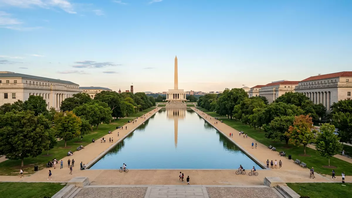
National Mall is a long, landscaped green axis between the United States Capitol and the Washington Monument in Washington, D.C. Its lawns, tree groves, museums and memorials form a public landscape in which geometry and national history remain visible together.
A mile of lawn between Capitol and monument
The historic Mall extends west from the Capitol grounds to the Washington Monument. Constitution Avenue borders it to the north, while Independence Avenue borders it to the south. The central vista is arranged along an east-west line, with broad grass panels extending towards the obelisk.
The National Park Service describes the historic Mall as a landscaped lawn one mile long. Its centre contains long panels of grass separated by cross streets and a gravel path. Tree groves run along both sides, framing the open space without enclosing it. historic Mall landscape
The word National Mall also covers a broader group of landscapes beyond the central lawn. This wider area includes the Washington Monument grounds and West Potomac Park, where the Lincoln, Jefferson, Franklin Delano Roosevelt, Vietnam Veterans, Korean War Veterans and World War II memorials stand.
From L’Enfant’s plan to the McMillan landscape
Pierre Charles L’Enfant placed the Mall within his 1791 plan for the federal city. His proposed avenue linked the Capitol with the Potomac River and established an open public axis within Washington’s planned streets.
The landscape changed during the nineteenth century. A canal crossed the northern side in 1820, and railway tracks later interrupted the eastern section. Andrew Jackson Downing received a commission for a public park in 1851, bringing a garden-based design into the Mall’s history.
The McMillan Commission produced a new plan in 1902. Daniel Burnham, Charles McKim, Frederick Law Olmsted Jr and Augustus Saint-Gaudens were among the figures associated with this work. The plan restored a formal monumental landscape, with lawns, tree-lined spaces and public buildings shaping the central axis. McMillan Commission plan
The National Mall entered the National Register of Historic Places in 1966. Its registered boundary was extended in 2016, reflecting the wider historic landscape around the central greensward and memorial grounds. National Register designation
Monuments, museums and civic space
The Mall brings together institutions and memorials along a continuous public setting. The United States Capitol marks the eastern end of the central axis, and the Washington Monument rises at its western end. Beyond the monument, the broader Mall landscape reaches towards the Lincoln Memorial and the Potomac basin.
Smithsonian museums line the north and south sides of the central grounds. Their buildings place art, science, history and culture beside the lawns, while memorials occupy the wider spaces towards West Potomac Park. The result is a landscape that combines open grass, formal routes, monumental architecture and public institutions.
The Mall also functions as a civic setting. Ceremonies, demonstrations and public gatherings take place across its lawns and approaches. The open layout leaves the Capitol, Washington Monument and memorial buildings visible as separate landmarks within one connected urban composition.
The history of the space is therefore readable through its physical arrangement. L’Enfant’s 1791 axis, the McMillan plan of 1902 and the National Register designation of 1966 belong to different stages of Washington’s development, while the long lawn remains the central visual element.
Visiting National Mall: what travellers from Western Europe should know
- National Mall lies in central Washington, D.C., between the United States Capitol and the Washington Monument. Metrorail stations serve the surrounding Capitol, Smithsonian and Federal Triangle areas.
- The central landscape is extensive and largely open. Walking routes cross broad lawns, paved drives and tree-lined paths, with the Lincoln Memorial and West Potomac Park continuing beyond the Washington Monument.
- The official language is English and the currency is the United States dollar.
- Nearby landmarks include the United States Capitol, the White House grounds, the Smithsonian museums and the Tidal Basin.
Searching for National Mall on social platforms
These links open searches for National Mall on each platform.
Frequently asked questions about National Mall
Where is National Mall?
National Mall is in central Washington, D.C., between the United States Capitol and the Washington Monument. The wider Mall landscape extends towards West Potomac Park and the Potomac River.
What can visitors expect on a visit?
Visitors encounter broad lawns, tree-lined paths, museums, memorials and long views between major civic landmarks. The area is an extensive outdoor urban landscape rather than a single enclosed attraction.
What makes National Mall distinctive?
Its defining feature is the formal axis connecting the Capitol and Washington Monument. The landscape also brings together Pierre Charles L’Enfant’s 1791 plan, the McMillan plan of 1902 and a National Register designation dating from 1966.


