
Nyerere National Park: Tanzania’s vast southern wilderness
Published on 08/15/2026 at 14:56 | Editorial responsibility: Rafael Müller, Editor-in-Chief AD HOC NEWS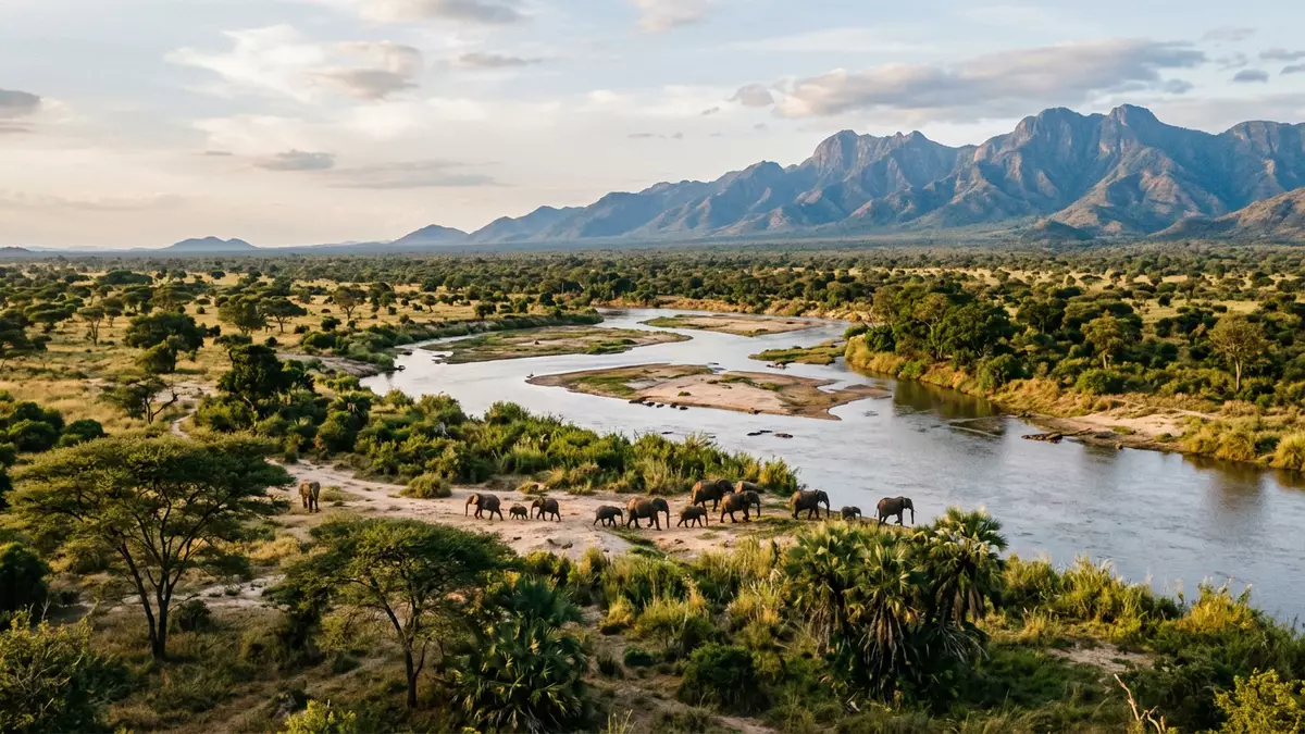
Nyerere National Park in southeastern Tanzania is a vast protected wilderness shaped by the Rufiji River and its floodplains, stretching across the Morogoro region and neighbouring districts. Covering about 30,893 km² (11,928 sq mi), it is recognised as the largest national park in Tanzania and one of the biggest on the African continent, carved from the northern tourism section of the former Selous Game Reserve and formally established in 2019 in honour of Julius Kambarage Nyerere, Tanzania’s founding president.
A national park born from the Selous wilderness
The landscape now known as Nyerere National Park forms the northern, western and southern photographic section of what was once the Selous Game Reserve, a UNESCO-listed wilderness in southern Tanzania that covers a far larger ecosystem of around 50,000 km² (19,000 sq mi).Nyerere National Park The reserve was formally divided in 2019, when the northern tourism area was upgraded to national park status as Nyerere National Park, while the remaining southern hunting blocks continue under the Selous name.divided in 2019
This new park designation gave a separate identity to a landscape long known among safari specialists for its scale and remoteness. The park lies in southeastern Tanzania within the Rufiji River basin, with its boundaries reaching into Lindi, Pwani, Ruvuma and the southeastern part of Morogoro region, creating an immense mosaic of protected terrain under a single national park name.Rufiji River basin
Rivers, lakes and miombo: the park’s southern Tanzanian landscapes
The defining feature of Nyerere National Park is the Rufiji River, which carves its way through the park with broad meanders, side channels and seasonal sand rivers, feeding a network of lakes and swamps set within open grasslands and woodlands.Rufiji River Much of the park is covered in miombo woodland, a characteristic southern African dry forest dominated by tall, light-barked trees with open understorey, interspersed with riverine forest strips, grass plains and seasonally inundated floodplains along the main watercourses.miombo woodlands and wetlands
This variety of habitats has supported a remarkable range of plants and animals within the wider Selous–Nyerere ecosystem, with thousands of recorded plant species and significant populations of elephants, buffalo, hippos and crocodiles. The interplay of dry woodland ridges, open plains and water channels creates a landscape in which broad views over savanna meet pockets of dense vegetation along the river, with the Rufiji’s lakes forming natural focal points for wildlife and for boat-based safaris.
Wildlife and safari experiences in Tanzania’s largest national park
The scale of Nyerere National Park and its mix of wetlands and woodlands make it an important stronghold for a wide range of large mammals. The wider ecosystem supports globally significant concentrations of elephants and buffalo, while hippos and crocodiles thrive along the Rufiji River channels and lakes.large mammal concentrations The park is also known among safari specialists as one of Africa’s key areas for African wild dogs, which move across the floodplains and woodland in extended packs, and for predators such as lions and hyenas that follow the grazing herds.
Safari operators emphasise the diversity of experiences in Nyerere compared with many other parks in Tanzania. In addition to conventional vehicle-based game drives, the presence of broad lakes and slow river stretches allows for boat safaris along channels lined with doum palms and sandbanks, while walking safaris in selected areas offer closer encounters with the park’s miombo woodland and riverine habitats.boat and walking safaris The combination of water-based and land-based exploration reflects the park’s identity as a river-carved wilderness rather than a single open plain.
Visiting Nyerere National Park: what travellers from Western Europe should know
- Nyerere National Park lies in southeastern Tanzania within the Rufiji basin, with road access to gates such as Mtemere from Dar es Salaam and routes linking to the Morogoro region.
- The park’s terrain ranges from flat floodplains and lakeshores to low wooded ridges, and time on safari typically involves driving on unsealed tracks and boarding boats along the main channels.
- The official language is Swahili and the currency is the Tanzanian shilling.
- Entry requirements depend on your nationality; UK travellers can check the FCDO travel advice at gov.uk/foreign-travel-advice, Irish travellers the Department of Foreign Affairs at ireland.ie.
Searching for Nyerere National Park on social platforms
These links open searches for Nyerere National Park on each platform.
Frequently asked questions about Nyerere National Park
Where is Nyerere National Park in Tanzania?
Nyerere National Park lies in southeastern Tanzania within the Rufiji River basin, with its protected area spanning parts of Lindi, Pwani, Ruvuma and southeastern Morogoro region.
What can visitors expect on a visit to Nyerere National Park?
Visitors encounter a very large protected landscape of miombo woodland, lakes and river channels, explored through vehicle game drives, boat safaris along the Rufiji and, in some areas, guided walking safaris.
What makes Nyerere National Park distinctive among Tanzania’s parks?
Its combination of immense size, river-fed wetlands and woodlands, along with boat-based wildlife viewing on the Rufiji, distinguishes Nyerere from many other Tanzanian safari destinations, which are more focused on open plains alone.


