
Parc national des Calanques where limestone meets the sea
Published on 09/22/2026 at 06:25 | Editorial responsibility: Rafael Müller, Editor-in-Chief AD HOC NEWS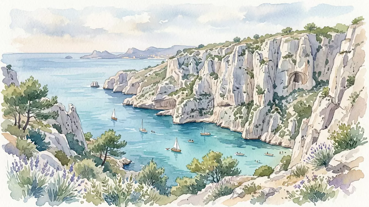
Parc national des Calanques is a coastal landscape beside Marseille, where pale limestone ridges descend into narrow Mediterranean inlets. Created on 18 April 2012, the park joins land, sea and islands in a protected territory whose geology remains visible from the cliff paths to the seabed.
Parc national des Calanques and its limestone coastline
The calanques are steep-sided rocky inlets cut into a massif formed from marine sediment. Much of the rock is compact urgonian limestone, a pale material containing fossils from the warm seas of the Mesozoic era. The wider landscape also includes dolomitic limestone, sandy limestone, sandstone and poudingue, a conglomerate made from rounded pebble debris.
Jurassic and Cretaceous deposits make the cliffs a geological record as well as a coastal setting. Tectonic movements raised the former seabed, while erosion and changing sea levels shaped valleys, caves, ridges and submerged sections of the coast. The result is a landscape of white rock, dark cavities, narrow coves and open water.
Named calanques include Sormiou, Morgiou, Sugiton, Port-Miou, Port-Pin and En-Vau. Their forms vary from sheltered inlets with small beaches to steep ravines whose walls reach directly towards the sea. Cape Canaille, near Cassis and La Ciotat, adds a contrasting coastal escarpment to the eastern side of the protected area.
From Marseille’s hills to the Mediterranean seabed
Parc national des Calanques is both terrestrial and marine. Its land reaches through the southern districts of Marseille towards Cassis and La Ciotat, while the marine area includes coastal waters, islands, underwater caves and a seabed shaped by cliffs, slopes and submarine canyons. The park was France’s tenth national park when the decree creating it was signed in 2012. the park’s creation date is 18 April 2012.
Below the surface, Posidonia oceanica forms meadows in the Mediterranean seabed. The plant is not an alga, and its long leaves shelter fish, invertebrates and other marine life. Deeper habitats include coralligenous structures, red coral colonies and yellow gorgonians attached to rocky walls. The underwater landscape continues the geological character visible above water.
The marine environment includes species such as wrasses, porgies, seahorses, noble pen shells and Mediterranean slipper lobsters. Underwater caves contain specialised communities, including red coral and carnivorous sponges. The park’s terrestrial habitats support reptiles, bats and birds, including Bonelli’s eagle and European shags along the coast.
Human traces among the calanques
The cliffs and coves also contain a long record of human activity. The Cosquer Cave preserves Paleolithic paintings below the present sea level, while archaeological traces occur in other caves and rocky shelters. The submerged setting of the cave connects prehistoric imagery with the changing coastline described by the park’s geology.
From the sixteenth century, agriculture and livestock farming shaped parts of the hillsides. Dry-stone restanques, or terraces, remain among the vegetation. Fishing communities also established cabanons in coves such as Callelongue, Sormiou and Morgiou. These small buildings form part of the cultural landscape beside working harbours, paths and rocky shorelines.
Other heritage includes forts, lighthouses, bastides, artists’ villas, industrial remains, religious buildings and shipwrecks. Château d’If, the Planier lighthouse, Hôpital Caroline and Parc du Mugel connect the national park with the history of Marseille and the surrounding coast. The combination of cliffs, sea habitats and human structures gives each approach a different character.
The park’s identity therefore rests on a visible meeting of materials and environments: limestone above, seawater below, and traces of settlement between them. Parc national des Calanques is a landscape where a Jurassic and Cretaceous seabed appears as cliffs beside Posidonia meadows and fishing coves.
Visiting Parc national des Calanques: what travellers from Western Europe should know
- Parc national des Calanques lies south-east of Marseille and extends towards Cassis and La Ciotat. RTM buses reach entrances from Marseille, including routes towards Sormiou, Morgiou and Sugiton.
- From Cassis, the SNCF railway station connects with the town, while local services continue towards the entrance near Port-Miou. The coastal approaches include Port-Miou, Port-Pin and En-Vau.
- Walks cross limestone paths, rocky ground, steep slopes and exposed coastal terrain. Routes towards coves can involve substantial walking from bus stops or town centres.
- The park includes land, islands and marine areas. Boat trips, swimming, diving and coastal walking encounter different parts of the same protected landscape.
- The official language is French and the currency is the euro.
Searching for Parc national des Calanques on social platforms
These links open searches for Parc national des Calanques on each platform.
Frequently asked questions about Parc national des Calanques
Where is Parc national des Calanques?
It lies on the Mediterranean coast beside Marseille, extending towards Cassis and La Ciotat in southern France.
What can visitors expect in the park?
Visitors encounter limestone cliffs, rocky coves, coastal paths, islands, marine habitats and cultural sites linked with fishing, agriculture and prehistoric settlement.
What makes the park distinctive?
Its protected territory combines terrestrial, marine and island environments. Jurassic and Cretaceous limestone, Posidonia meadows and human heritage appear within the same coastal landscape.


