
Parque Nacional Cotopaxi and the cone above Latacunga
Published on 09/23/2026 at 18:43 | Editorial responsibility: Rafael Müller, Editor-in-Chief AD HOC NEWS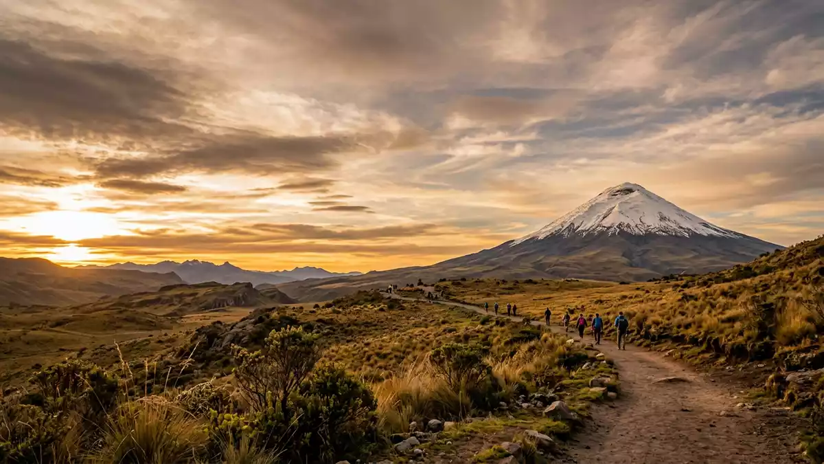
Parque Nacional Cotopaxi is a high Andean protected area near Latacunga, centred on the near-symmetrical cone of Cotopaxi. The active stratovolcano rises to 5,897 m (19,347 ft), above páramo grasslands, volcanic deposits and small lagoons.
Cotopaxi’s cone across the Andean plateau
The volcano gives the park its defining form. Its broad lower slopes rise from a high plateau, while lava, ash and lahar deposits mark the volcanic landscape around Cotopaxi and Rumiñahui. The park extends across the provinces of Cotopaxi, Pichincha and Napo, with its southern approach linked to Latacunga.
Cotopaxi belongs to the Avenue of the Volcanoes, a name Alexander von Humboldt used in 1802 for the chain of volcanoes across the central and northern Ecuadorian Andes. The mountain’s snow and ice cap contrasts with dark volcanic ground, open grassland and the broken outline of Rumiñahui. The official description of the protected area identifies its volcanic landscape.
A protected landscape shaped by fire and water
Parque Nacional Cotopaxi was created on 11 August 1975 through an interministerial agreement. Its protected area covers 32,255 hectares, with elevations reaching from high páramo to the summit of Cotopaxi. The landscape includes volcanic mountains, ash deposits, lava flows, wetlands and Andean valleys.
Water gathers in rivers and lagoons across the park. The Cutuchi, San Pedro, Pita, Pedregal, Tamboyacu and Tambo rivers rise from the volcanic highlands, while Limpiopungo is the best-known lagoon. At about 3,800 m (12,467 ft), it lies beneath views towards Rumiñahui and provides habitat for coots, Andean ducks and gulls. The park’s Limpiopungo lagoon forms a watery foreground to the volcanoes.
Páramo plants, Rumiñahui and Limpiopungo
Páramo is the dominant ecosystem, with bunch grasses, low shrubs, mosses and lichens. Plants recorded in the park include sigse, cacho de venado, sisán and Valeriana pilosa. The vegetation remains low across much of the exposed highland, while sheltered areas contain scattered Andean shrubs and small trees.
Wildlife includes Andean foxes, rabbits, skunks, deer, weasels, rodents and several amphibians and reptiles. Birds associated with the park include ducks, coots, hawks, Andean gulls and other highland species. Rumiñahui provides a second volcanic focus, with a rugged profile and several peaks beside the open waters of Limpiopungo. The park’s formal creation in August 1975 places this protected landscape within Ecuador’s modern conservation history.
Visiting Parque Nacional Cotopaxi: what travellers from Western Europe should know
- Parque Nacional Cotopaxi lies south of Quito and near Latacunga. The Pan-American Highway reaches the El Caspi approach, while the northern route runs through Machachi and Güitig towards the park.
- The terrain is high páramo, with volcanic ground, exposed slopes and an altitude that rises from about 3,400 m (11,155 ft) towards Cotopaxi’s 5,897 m (19,347 ft) summit.
- Limpiopungo is a high-altitude lagoon with a shoreline route, waterfowl and views of Rumiñahui. The Cotopaxi refuge lies far above the lower grasslands, on steep volcanic terrain.
- The official language is Spanish and the currency is the Ecuadorian dollar.
- Entry requirements depend on your nationality; UK travellers can check the FCDO travel advice at gov.uk/foreign-travel-advice, Irish travellers the Department of Foreign Affairs at ireland.ie.
- Conditions on the mountain change with the seasons; the local cable-car operators and alpine clubs provide information.
Searching for Parque Nacional Cotopaxi on social platforms
These links open searches for Parque Nacional Cotopaxi on each platform.
Frequently asked questions about Parque Nacional Cotopaxi
Where is Parque Nacional Cotopaxi?
The park is in central Ecuador, near Latacunga and south of Quito. It spans parts of Cotopaxi, Pichincha and Napo provinces.
What can visitors expect there?
Visitors encounter high páramo, volcanic slopes, Limpiopungo lagoon, Rumiñahui and views of Cotopaxi. The altitude and exposed terrain define the setting.
What makes Parque Nacional Cotopaxi distinctive?
The protected area combines a 5,897 m (19,347 ft) active stratovolcano with páramo grasslands, volcanic deposits and high-altitude wetlands.


