
Puerto de Cudillero and its harbour amphitheatre
Published on 09/23/2026 at 23:21 | Editorial responsibility: Rafael Müller, Editor-in-Chief AD HOC NEWS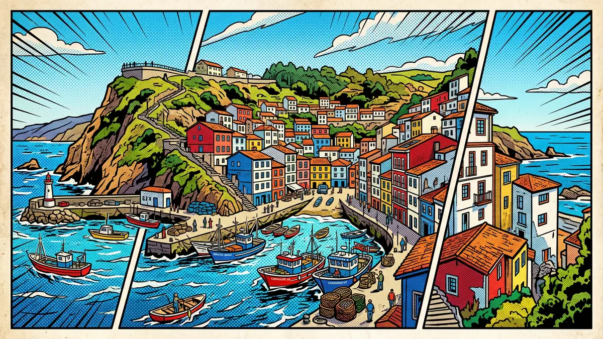
Puerto de Cudillero lies on Asturias’s northern coast, where a working fishing harbour occupies the base of a steep settlement. Its most recognisable feature is the relationship between the water and the houses: brightly coloured buildings rise around the harbour in a curved formation, while harbour walls enclose the modern basin.
The port is both a maritime workplace and the centre of Cudillero’s public life. Fishing boats, quays, sea-facing taverns and paths towards the lighthouse belong to the same compact landscape, making the harbour easy to understand as a place rather than a separate attraction.
Puerto de Cudillero beneath the coloured houses
Cudillero developed as a fishing settlement around its sheltered cove. The port and its earliest town are traditionally dated to the thirteenth century, and a document from 1285 records land in the port of Cudillero. That early reference connects the harbour with trade, settlement and access to the sea.
The town’s houses climb the slopes above the water, with projecting eaves and coloured windows. Their arrangement creates a visible amphitheatre around the harbour, while narrow streets and stairways connect the waterfront with higher viewpoints. The steep setting remains the defining physical fact of Puerto de Cudillero.
The harbour belongs to Asturias, a region on the Bay of Biscay with a long coastal fishing tradition. Cudillero’s maritime history includes hake, sardines and other catches, while the local expression “merluza de pincho” refers to hake caught with hook and line.
From medieval fishing port to enclosed basin
The older harbour lay beneath Punta Rebollera, where the lighthouse marks the coast. Its earlier protection came from a breakwater, while rough north-westerly weather could make the small basin difficult for the fishing fleet. Boats were hauled ashore in the area known as El Sable.
The present harbour is an artificial basin formed by harbour walls. The Moro breakwater extends from Punta de la Fuente del Asma, and another wall reaches towards Isla de la Cruz. An entrance channel passes through the former western breakwater.
Construction of the new port was completed in the early 1980s. The expanded basin changed the scale of the harbour while preserving its connection with the older settlement. Fishing boats and small craft occupy the water, with the town’s waterfront running close beside the quays.
This combination of older settlement and later harbour engineering can be read directly from the shore. The coloured houses belong to the steep town above, while the breakwaters define a broad, enclosed area below. The result is a place where medieval origins and twentieth-century infrastructure share one coastal setting.
Landmarks around the harbour
Puerto de Cudillero provides the lower point of a landscape linked by streets, steps and viewpoints. The lighthouse stands near Punta Rebollera, while La Garita, La Atalaya and El Pico are named viewpoints above the town. Paths between these places reveal different angles on the basin and the houses.
San Pedro parish church belongs to the sixteenth century and contains Baroque carvings. The Chapel of El Humilladero is the oldest building in the town. Both buildings add historical depth to the harbour landscape without standing directly on the water.
At the waterfront, fish taverns occupy a narrow cobbled square beside the sea. The harbour therefore supports several visible layers: fishing infrastructure, boats, food businesses, religious buildings, hillside streets and coastal viewpoints.
The port’s shape gives Cudillero its particular visual order. Water occupies the centre, harbour walls frame the entrance, and houses rise around the slopes. Puerto de Cudillero is consequently read from several levels, from the quayside to the upper viewpoints and the lighthouse route.
Visiting Puerto de Cudillero: what travellers from Western Europe should know
- Puerto de Cudillero is in Cudillero, Asturias, on Spain’s northern coast. The town is reached by road, while local paths connect the harbour with La Garita, La Atalaya, El Pico and the lighthouse.
- The settlement rises steeply above the water. Walking involves cobbled streets, stairways and slopes between the quays, the houses and the viewpoints.
- The harbour is a working maritime area. Breakwaters, fishing boats, quays and the entrance channel form part of the setting.
- The official language is Spanish and the currency is the euro.
Searching for Puerto de Cudillero on social platforms
These links open searches for Puerto de Cudillero on each platform.
Frequently asked questions about Puerto de Cudillero
Where is Puerto de Cudillero?
Puerto de Cudillero is the harbour of Cudillero in Asturias, on Spain’s northern coast beside the Bay of Biscay.
What can visitors expect around the harbour?
Visitors find quays, fishing boats, sea-facing taverns, steep streets, hillside houses and routes towards the lighthouse and viewpoints.
What makes Puerto de Cudillero distinctive?
The harbour combines an artificial basin with a steep town whose coloured houses rise around the water in an amphitheatre-like formation.


