
River Walk in San Antonio: a city built around its river
Published on 09/05/2026 at 11:36 | Editorial responsibility: Rafael Müller, Editor-in-Chief AD HOC NEWS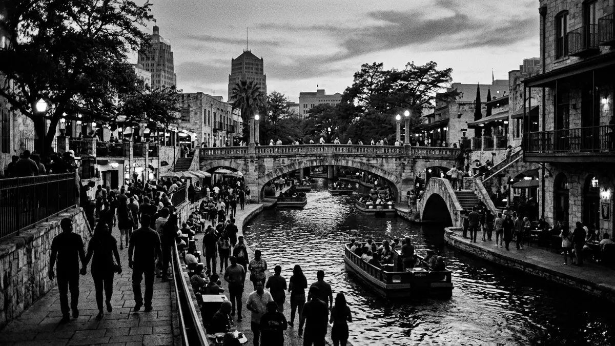
River Walk in San Antonio is a landscaped corridor of walkways, bridges and terraces built along the banks of the San Antonio River, turning a once flood-prone bend into a central urban waterfront.
The river corridor reshaped
River Walk follows the natural course of the San Antonio River as it loops through downtown, with pedestrian paths set below street level and stone walls holding the river in a defined channel.linear public park The result is a continuous promenade where streets cross above on bridges and life unfolds at river level. Walkways run close to the water, with staircases linking them to plazas and streets, and the river itself remains a moving, shallow stream rather than a canalised basin.
The setting is marked by mature trees and planting, including bald cypress whose trunks rise from the river edge and whose crowns reach towards the upper storeys of nearby buildings.bald cypress whose branches stretch The river passes under arched bridges and beside stone embankments, and the paths weave between outdoor seating areas, small gardens and open spaces. The walkable section in the central area extends for several kilometres, forming part of a larger programme of river improvements that links downtown to museum districts and historic missions.extensions of the Riverwalk to the North and to the South
From flood control to civic landscape
The origins of River Walk lie in flood control schemes drawn up in the early twentieth century after damaging floods on the San Antonio River, including a major flood in September 1921 that killed more than fifty people in the city.the worst flood in its history killed over fifty people Early plans discussed diverting the river through a concrete tunnel and paving over the downtown bend as part of a storm sewer system, but opposition from citizens led to a different approach.plans to convert the San Antonio river into a storm sewer system Out of that debate emerged the idea of keeping the river open and integrating flood control with public space.
In 1929 San Antonio architect Robert H. H. Hugman presented a proposal for landscaped river banks and commercial arcades along the existing bend, a concept that combined dams, gates and weirs with continuous walkways and planting.Robert H.H. Hugman submitted his vision Funding followed in 1938 under a Works Progress Administration river beautification project, and construction began in 1939 with Hugman overseeing the work.San Antonio River Beautification Project The original section comprised several kilometres of walkways, numerous bridges, staircases linking street level to the river, an outdoor amphitheatre and extensive landscaping, laying the foundations for the River Walk seen beside downtown streets today.completed the project in 1941
Layers of activity along the water
River Walk’s appeal lies in its mix of movement and stillness along the water, with boat traffic, pedestrians and outdoor dining sharing the same corridor. Sections of the promenade run beside restaurants and shops with terraces stepping down towards the river, while other stretches feel quieter and are lined by trees, planting and occasional artworks.outdoor theater and extensive landscaping Bridges, staircases and path junctions punctuate the route, creating small plazas and crossings where the river, city streets and buildings meet.
Beyond the historic core, River Walk has grown into a longer network of paths and waterway sections, including Museum Reach to the north and Mission Reach to the south, which connect downtown to cultural institutions and the string of Spanish colonial missions along the river.Pearl Brewery district, Museum Reach area Along these extensions the character changes from dense urban frontage to stretches where the riverbank feels more like a park, with landscaped edges, trails for walking and cycling, and restored riparian vegetation. Taken together, these sections make River Walk both a central gathering place and a longer urban route following the San Antonio River through different parts of the city.
Visiting River Walk: what travellers from Western Europe should know
- River Walk runs through central San Antonio in Texas, following the course of the San Antonio River below street level in the downtown area.
- The paths beside the river include staircases, changes of level and bridges, so moving along the corridor involves frequent steps and gradients rather than a single flat promenade.
- Further stretches extend north towards the Museum Reach and south towards Mission Reach, where riverbank trails pass landscaped parkland and historic mission sites.
- The official language is English and the currency is the United States dollar.
- Entry requirements depend on your nationality; UK travellers can check the FCDO travel advice at gov.uk/foreign-travel-advice, Irish travellers the Department of Foreign Affairs at ireland.ie.
Searching for River Walk on social platforms
These links open searches for River Walk on each platform.
Frequently asked questions about River Walk
Where is River Walk located?
River Walk runs along the San Antonio River in central San Antonio, Texas, with paths below street level through the downtown area.
What can visitors expect on a walk along the river?
Visitors encounter shaded walkways, bridges, staircases, restaurants and planted riverbanks, with different sections ranging from lively terraces to quieter landscaped stretches.
What makes River Walk distinctive among urban riverfronts?
River Walk combines early twentieth-century flood engineering with a continuous pedestrian landscape, integrating mature trees, historic structures and newer extensions towards museums and missions.


