
Ruta de las Flores, a highland road of coffee towns and waterfalls
Published on 09/01/2026 at 13:28 | Editorial responsibility: Rafael Müller, Editor-in-Chief AD HOC NEWS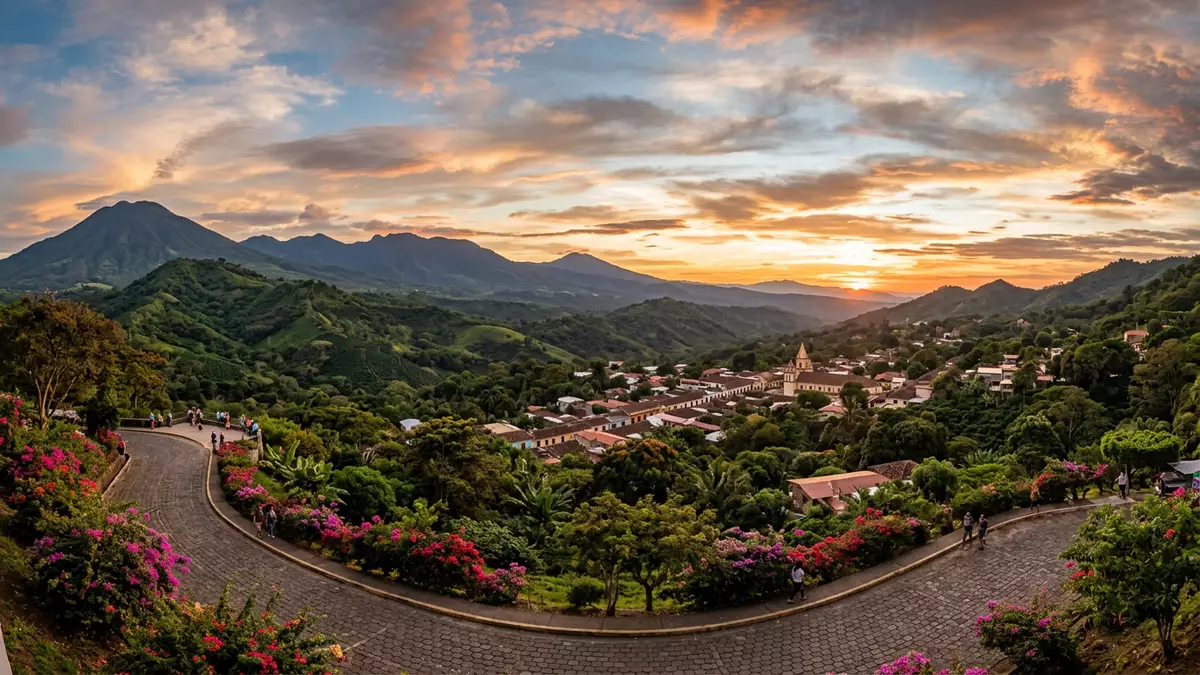
Ruta de las Flores is a short highland road in western El Salvador that links a chain of colonial towns such as Juayua with coffee landscapes and nearby waterfalls. Set on a plateau between volcanic peaks, the route has become a compact region where small-town streets, mountain views and coffee fincas sit within easy reach of one another.
A coffee road between Sonsonate and Ahuachapán
The road known as Ruta de las Flores runs through the western highlands of El Salvador, connecting the larger town of Sonsonate in the south with Ahuachapán in the north along a stretch of about 35 km (21 miles).stretch of scenic road Along this corridor the main highland settlements include Nahuizalco, Salcoatitán, Juayua, Apaneca and Concepción de Ataco, each sitting amid coffee plantations and hilly terrain.five colonial villages
Juayua lies roughly in the centre of the route, in the Sonsonate department, at an altitude around 1,000 m (3,280 ft) above sea level, which brings cooler highland air compared with the coastal lowlands.altitude of Juayua The towns are framed by the slopes of nearby volcanoes, and coffee fincas occupy much of the surrounding countryside, giving the road its character as a link through one of El Salvador’s important coffee-growing regions.coffee plantations and volcanoes
Juayua and the highland towns of the route
Juayua itself is described as the largest of the main towns on Ruta de las Flores and has pre-Columbian origins, with its name linked to the Nahuat language and the idea of a place of the purple orchid.largest of the five towns Around its central park there are streets of low-rise buildings, a church and small-scale markets, while the surrounding hills give views over coffee plots and forested slopes. Other towns along the route, such as Apaneca and Concepción de Ataco, have compact centres of painted facades and cobbled streets, and Salcoatitán and Nahuizalco feel smaller, with roadside clusters of houses and shops close to the highway.
The chain of towns makes Ruta de las Flores more a small region than a single road, with each settlement offering a slightly different character. Some places focus strongly on coffee culture, with fincas that can be visited in the hills around town. Others are known for street art or handicrafts, with murals and artisan stalls colouring the lanes. The highland setting ties them together: wherever travellers stay along the route, they encounter views of volcanic ridges and coffee terraces from the edges of town.
Waterfalls, trails and countryside around Juayua
One of the most notable outdoor features around Juayua is a cluster of waterfalls in the nearby hills, reached on trails that leave from the edge of town. Local guides describe routes that link several cascades, sometimes referred to collectively as Las Siete Cascadas, and shorter walks concentrate on Chorros de la Calera, a larger waterfall with pools below it.hiking to numerous waterfalls These outings follow footpaths over uneven ground, passing coffee plants, small streams and patches of forest before reaching the falls.
Beyond the waterfall trails, the countryside along Ruta de las Flores allows for walks between towns along the roadside or on parallel paths, with gentle gradients in some stretches and steeper sections as the road climbs and descends across the plateau. Travellers encounter roadside stalls, viewpoints and occasional small chapels beside the highway. The consistent presence of coffee plantations means that even short walks tend to pass rows of coffee bushes under taller shade trees, giving the landscape a layered green structure.
Visiting Ruta de las Flores: what travellers from Western Europe should know
- Ruta de las Flores lies in western El Salvador, between Sonsonate and Ahuachapán in the highlands; buses link San Salvador and Santa Ana with Juayua and other towns along the route.
- The terrain in and around the towns includes hilly streets and footpaths, together with countryside trails to waterfalls that involve uneven ground and modest climbs.
- The region is inland and at altitude, so weather can differ from the Pacific coast, and conditions on rural trails vary with the season and recent rainfall.
- The official language is Spanish and the currency is the United States dollar.
- Entry requirements depend on your nationality; UK travellers can check the FCDO travel advice at gov.uk/foreign-travel-advice, Irish travellers the Department of Foreign Affairs at ireland.ie.
Searching for Ruta de las Flores on social platforms
These links open searches for Ruta de las Flores on each platform.
Frequently asked questions about Ruta de las Flores
Where is Ruta de las Flores and which towns does it connect?
Ruta de las Flores is in western El Salvador, linking Sonsonate with Ahuachapán and passing through highland towns including Nahuizalco, Salcoatitán, Juayua, Apaneca and Concepción de Ataco.
What can travellers expect when visiting Juayua along the route?
Travellers find a highland town with a central park, colonial streets, nearby coffee fincas and access to trails that lead to a series of waterfalls in the surrounding hills.
What makes Ruta de las Flores distinctive compared with other regions?
Its short road concentrates several colonial towns, coffee landscapes, volcanic backdrops and rural waterfall hikes into a compact area that can be explored town by town.


