
Walking Boston’s Freedom Trail of revolutionary landmarks
Published on 09/17/2026 at 22:52 | Editorial responsibility: Rafael Müller, Editor-in-Chief AD HOC NEWS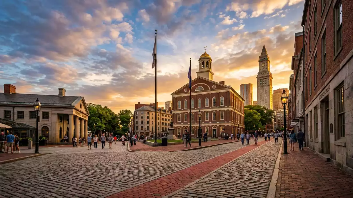
Freedom Trail is a marked walking route through Boston that links a sequence of historic sites associated with the American Revolution and the early United States. The trail forms a continuous red-brick line on the pavement, guiding pedestrians from Boston Common through central neighbourhoods to the waterfront and Charlestown.
A red-brick corridor through Boston’s history
Freedom Trail runs for about 4 km (2.5 miles) and connects formal trailheads at Boston Common and Bunker Hill Monument in Charlestown. The route passes 16 officially recognised sites, many dating from the eighteenth century or earlier, and ties together Boston’s downtown, the North End and Charlestown.2.5-mile trail The red-brick line underfoot is an enduring feature of the cityscape and makes the path easy to follow without a map.red brick line
The trail grew from a shorter marked route in the mid-twentieth century and later expanded to reach both Bunker Hill Monument and the USS Constitution at Charlestown Navy Yard.expanded to include Bunker Hill Monument and USS Constitution Along its length, it crosses older streets and squares that remain part of Boston’s everyday fabric, so walking the route brings together residential blocks, commercial districts and historic precincts rather than separating them.
Sixteen sites from colonial Boston to the early republic
The official Freedom Trail sites range from public spaces to churches, burying grounds, civic buildings and a warship. At the southern end, the trail starts at Boston Common, recognised as the oldest public park in the United States, and climbs towards the Massachusetts State House on Beacon Hill.Boston Common and State House Nearby, Park Street Church and the Granary Burying Ground mark early religious life and hold graves of figures from the revolutionary period.Granary Burying Ground and Park Street Church
Further along, the trail threads past King’s Chapel and its burying ground, the former Boston Latin School site with a statue of Benjamin Franklin, and the Old Corner Bookstore. Old South Meeting House and Old State House stand close together in the commercial core and recall the debates and political assemblies that preceded independence.Old South Meeting House and Old State House In the same area, markers at the Boston Massacre Site and Faneuil Hall link the street to specific events that shaped the break from British rule.
From North End lanes to Charlestown’s waterfront and hilltop
North of Faneuil Hall, Freedom Trail enters the North End, a district of narrow streets and older housing that preserves traces of colonial Boston. Here the route reaches Paul Revere House, built around 1680 and regarded as the oldest surviving structure in downtown Boston.Paul Revere House built around 1680 It then continues to Old North Church, associated with the lantern signal of April 1775 and the subsequent ride to Lexington and Concord, and on to Copp’s Hill Burying Ground.Old North Church
Crossing the river into Charlestown, the trail reaches the USS Constitution, an early nineteenth-century wooden frigate moored at Charlestown Navy Yard, before rising to Bunker Hill Monument on its hilltop. These final stops extend the story beyond the city centre and connect the path to the harbour and to the site associated with the Battle of Bunker Hill.USS Constitution and Bunker Hill Monument The combination of ship, waterfront and obelisk gives the northern end of Freedom Trail a distinct, open setting compared with the denser streets around Boston Common.
Visiting Freedom Trail: what travellers from Western Europe should know
- Freedom Trail runs through central Boston and Charlestown, beginning at Boston Common and continuing towards Bunker Hill Monument via the North End and Charlestown Navy Yard.
- The route follows pavements and public squares, with some sections on sloping streets and stairways, and covers several kilometres on foot.
- Boston is in the United States; the official language is English and the currency is the US dollar.
- Entry requirements depend on your nationality; UK travellers can check the FCDO travel advice at gov.uk/foreign-travel-advice, Irish travellers the Department of Foreign Affairs at ireland.ie.
Searching for Freedom Trail on social platforms
These links open searches for Freedom Trail on each platform.
Frequently asked questions about Freedom Trail
Where is Freedom Trail located?
Freedom Trail runs through central Boston in Massachusetts, United States, starting at Boston Common and extending northwards into the North End and Charlestown.
What should travellers expect when walking Freedom Trail?
Travellers follow a continuous red-brick line along pavements and squares, passing historic churches, burying grounds, civic buildings, a warship and a hilltop monument.
What makes Freedom Trail distinctive among historic routes?
Freedom Trail is distinctive because it links sixteen named sites from colonial and revolutionary Boston in a single marked urban route of around 4 km (2.5 miles).


