

Xcaret’s rivers, Maya ruins and limestone coast near Playa del Carmen
Published on 08/25/2026 at 19:30 | Editorial responsibility: Rafael Müller, Editor-in-Chief AD HOC NEWS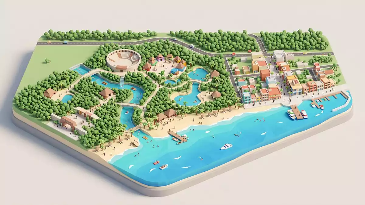
Xcaret on Mexico’s Riviera Maya coast south of Playa del Carmen is an eco?archaeological park where underground rivers, traces of Maya settlement and Caribbean shoreline share the same limestone landscape. Opened to visitors in December 1990, it grew from land acquired by architect Miguel Quintana Pali and partners and developed into a large park that weaves nature and heritage into a single coastal site.
Rivers in limestone: the park’s underground spine
The most striking feature at Xcaret is the network of underground rivers running through porous limestone beneath the park, emerging in inlets, channels and flooded caverns that visitors encounter throughout the grounds. The park occupies around 81 ha (200 acres) of jungle, coastal rock and natural inlet, using these watercourses as a visible thread that connects inland paths with the Caribbean shore.81 ha (200 acres) The limestone itself is part of the wider geology of Quintana Roo, where cenotes and subterranean rivers form over long periods as slightly acidic water dissolves carbonate rock and roofs collapse into sinkholes.
When Miguel Quintana Pali began clearing the site after acquiring several hectares near Playa del Carmen in 1984, workers uncovered cenotes and underground rivers running under the jungle alongside visible traces of Maya building. Recognising the concentration of natural and archaeological features, Quintana Pali joined forces with Oscar, Marcos and Carlos Constandse, forming what became Grupo Xcaret and pursuing the idea of an ecological park open to visitors.Miguel Quintana Pali and the Constandse brothers Over the following years these discovered rivers were integrated into walkways, swimming routes and viewing areas, turning a hidden geological system into one of the defining experiences of the park.
Maya port, temples and later chapel
Long before themed attractions arrived, the area around Xcaret formed part of a Maya settlement that functioned as a port and ceremonial centre linked to coastal trade routes along the Caribbean.Maya port and ceremonial centre Archaeological work under Mexico’s National Institute of Anthropology and History has documented small temples, platforms and other stone structures across the site, with dating concentrated between about AD 1200 and 1500 when coastal towns along the Riviera Maya connected inland communities with sea?going traffic.dated mainly to AD 1200–1500 Some remains lie within the current park as low walls and reconstructed elements, so paths and terraces pass close to pre?Hispanic stonework rather than isolating it behind barriers.
The Maya settlement at Xcaret was strategically placed near the sea yet slightly inland, and sources on its history describe defensive walls and a role as an active port town on the Riviera Maya.defensive walls and port role It was still occupied when Spanish settlers arrived in the sixteenth century, and in 1548 a chapel was built there, indicating that the colonial authorities considered the site significant.chapel built in 1548 The walls of this chapel remain visible, adding a later historical layer to a landscape otherwise dominated by Maya remains and natural rock.
From coastal jungle to eco?archaeological park
Xcaret’s modern form dates to the late twentieth century when Quintana Pali and his partners reshaped a tract of coastal jungle and limestone into an eco?archaeological park that retains existing geology and ruins while adding visitor infrastructure. The group acquired land in 1984, contacted the National Institute of Anthropology and History to oversee reconstruction of Maya structures, and opened the park to the public in December 1990.opened in December 1990 Over later years Xcaret expanded to cover around 81 ha (about 200 acres) and became the flagship property of Grupo Xcaret in the tourism corridor between Cancún and Tulum.flagship park of Grupo Xcaret
In its present form Xcaret is described as an eco?archaeological park that combines elements of a water park, theme park and wildlife sanctuary within a single site.eco?archaeological park with multiple attractions Underground rivers, natural inlet and coastal lagoon structure the layout, while areas of tropical vegetation host wildlife enclosures, a butterfly pavilion and trails through jungle planting.underground rivers, wildlife and jungle Alongside them stand reconstructed Maya platforms, viewing points over the Caribbean and performance spaces used for large cultural shows, so heritage, ecology and staged experiences sit side by side within the park’s boundaries.
Visiting Xcaret: what travellers from Western Europe should know
- Xcaret lies on the Riviera Maya coast of Quintana Roo, a short distance south of Playa del Carmen along the Chetúmal–Puerto Juárez highway in eastern Mexico. It is reached by road from Playa del Carmen and Cancún, and the nearest major international airport is in Cancún.
- The park occupies coastal limestone terrain with paths that climb over rock, cross bridges above rivers and descend towards underground channels, so visitors spend time walking on uneven surfaces and moving between shaded interiors and exposed shore.
- The official language is Spanish and the currency is the Mexican peso.
- Entry requirements depend on your nationality; UK travellers can check the FCDO travel advice at gov.uk/foreign-travel-advice, Irish travellers the Department of Foreign Affairs at ireland.ie.
Searching for Xcaret on social platforms
These links open searches for Xcaret on each platform.
Frequently asked questions about Xcaret
Where is Xcaret located?
Xcaret is on the Riviera Maya coast in the Mexican state of Quintana Roo, a short distance south of Playa del Carmen and within reach of Cancún.
What can visitors expect at Xcaret?
Visitors encounter underground rivers, coastal inlet, jungle trails, wildlife areas and visible remains of a Maya port town, alongside performance spaces and other themed attractions.
What makes Xcaret distinctive among Riviera Maya sites?
Xcaret is distinctive for bringing underground rivers, coastal limestone, Maya ruins and later structures such as the 1548 chapel into one integrated eco?archaeological park opened in December 1990.


