
Xunantunich and the Maya monuments above the Mopan Valley
Published on 09/24/2026 at 01:23 | Editorial responsibility: Rafael Müller, Editor-in-Chief AD HOC NEWS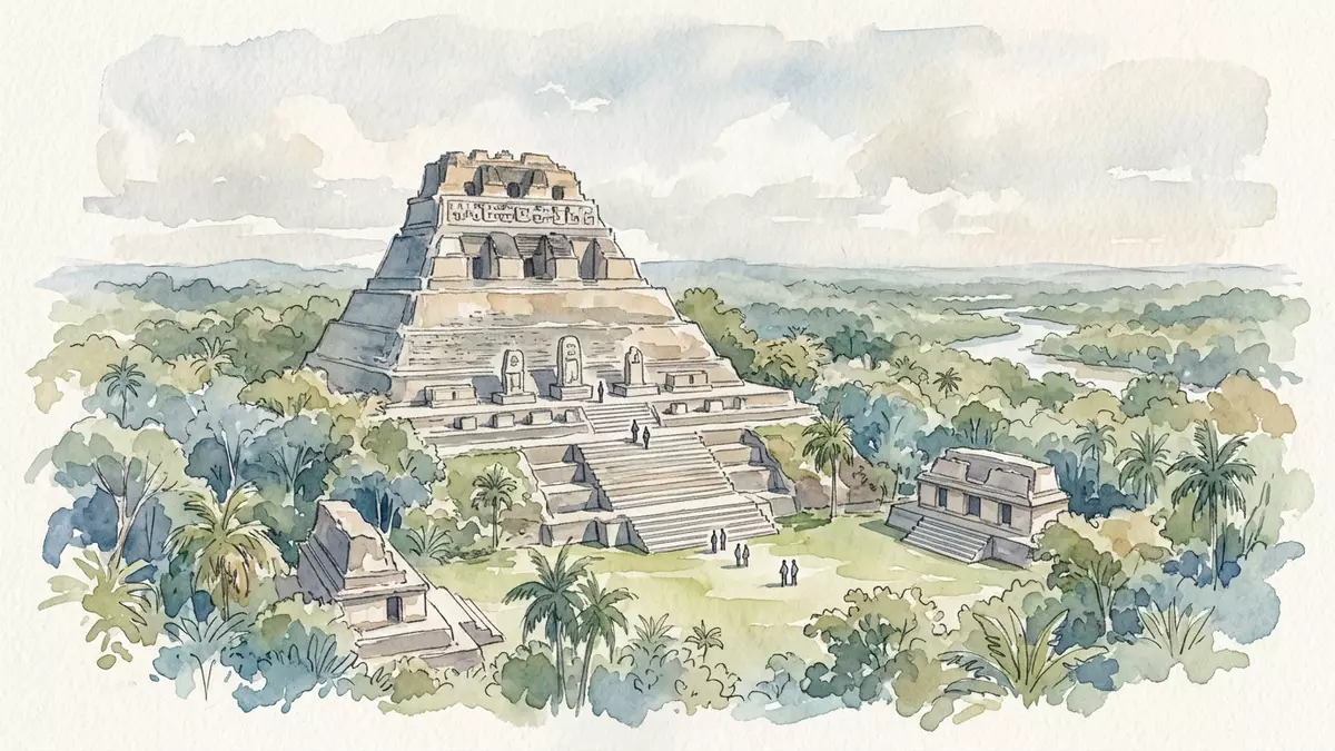
Xunantunich is a Maya archaeological site on a ridge above the Mopan Valley near San Ignacio, Belize. Its central monument, El Castillo, rises above broad plazas and gives the site a strongly vertical profile. The settlement flourished during the Late and Terminal Classic periods, when monumental architecture shaped the civic and ceremonial centre.
Xunantunich on a ridge above the Mopan River
The site occupies a limestone ridge in western Belize, close to the modern town of San Ignacio and near the border with Guatemala. A hand-operated ferry crosses the Mopan River before the road climbs towards the archaeological reserve. The approach places the ruins within a landscape of forested slopes, river valleys and karst terrain.
Xunantunich means “Stone Woman” in a modern Maya language. The name is linked to a local apparition story, while the visible remains belong to a much older Maya city. Archaeological activity at the ridge reaches back to the Preclassic period, but the settlement became a major regional centre during the Late Classic and Terminal Classic periods, approximately from AD 600 to 900. Late Classic development provides the clearest historical frame for the architecture visible across the ridge.
El Castillo and the architecture of the central plaza
El Castillo is the largest structure at Xunantunich. Known to archaeologists as Structure A6, it rises approximately 40 metres above the plaza. Its stepped mass contains terraces, stairways and upper buildings, with carved and modelled decoration associated with the monument’s later construction phases.
The monument was built through several stages. Archaeological evidence places an early construction phase around the eighth century AD, followed by later work around the ninth century. Plaster friezes once extended across parts of the upper building, and surviving reproductions show imagery associated with Maya cosmology. Structure A6 and El Castillo form the visual centre of the site.
From the upper levels, the arrangement of plazas and surrounding ridges becomes legible as a connected urban landscape. Other structures frame the central spaces, including buildings associated with public ceremony, administration and elite activity. The architecture is not a single isolated temple, but a group of platforms, stairways, courtyards and raised monuments.
Plazas, carved dates and the changing Maya city
Xunantunich developed during a period of political change across the Belize Valley. Its monuments belong mainly to the Classic Maya tradition, whose cities combined public plazas, elevated temples, palaces and inscribed stone monuments. The site’s position near the Mopan River connected it with a wider network of settlements in the valley.
Several plazas organise the surviving remains. Plaza A-I lies beside El Castillo, while additional courtyards contain platforms and buildings from different phases of occupation. Stelae and architectural inscriptions record dates in the Maya calendar. One carved date associated with the site corresponds to AD 849, placing it within the Terminal Classic period.
The city was abandoned around the end of the first millennium AD. Its decline formed part of the broader transformation of Maya political centres across the lowlands, although the causes differed between places and remain connected to local archaeological evidence. Xunantunich preserves the monuments of a society that continued building and using the ridge after several neighbouring centres had changed.
Modern archaeological work began in the late nineteenth century, and major excavations took place during the twentieth century. The remains visible across the ridge therefore combine ancient masonry with the results of long archaeological investigation. Xunantunich’s Classic-period history places its monumental expansion within the sixth to ninth centuries AD.
Visiting Xunantunich: what travellers from Western Europe should know
- Xunantunich lies near San Ignacio in western Belize. The route crosses the Mopan River by a hand-operated ferry before reaching the ridge.
- The site occupies uneven limestone ground, with steep stairways and substantial climbs around the plazas and El Castillo.
- The official language is English and the currency is the Belize dollar.
- Nearby San Ignacio provides access to the wider Cayo District, including the Mopan Valley and other Maya archaeological sites.
Searching for Xunantunich on social platforms
These links open searches for Xunantunich on each platform.
Frequently asked questions about Xunantunich
Where is Xunantunich?
Xunantunich is in western Belize, near San Ignacio and the Mopan River. The archaeological reserve occupies a ridge in the Cayo District.
What can visitors see there?
Visitors encounter plazas, platforms, stairways, carved monuments and El Castillo. The site combines broad ceremonial spaces with elevated Maya architecture.
What makes Xunantunich distinctive?
El Castillo rises approximately 40 metres above the central plaza and dominates the ridge. Its scale, terraces and surviving decorative elements define the site’s character.


