
Yehliu Dizhi Gongyuan and the sculpted sandstone cape of Neu-Taipeh
Published on 09/21/2026 at 09:33 | Editorial responsibility: Rafael Müller, Editor-in-Chief AD HOC NEWS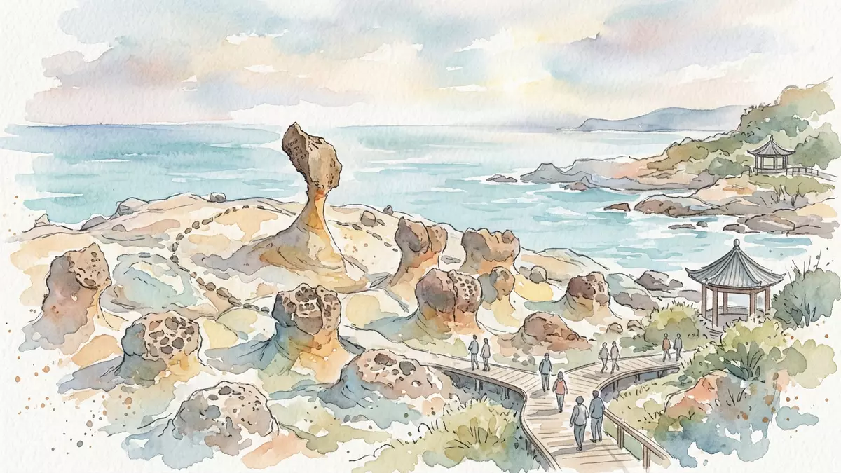
On the north coast of Neu-Taipeh in Taiwan, Yehliu Dizhi Gongyuan unfolds along a narrow sandstone cape where the land reaches into the sea and breaks into a field of strange rock forms. The cape of Yehliu extends for around 1,700 m (5,577 ft) from Datun Mountain into the Taiwan Strait, creating a long, low platform that exposes layers of yellow-brown rock to waves and salt-laden air.a cape of about 1,700 metres At Yehliu Dizhi Gongyuan, this exposed edge has become one of Taiwan’s recognised geological landscapes, visited as much for its science as for its otherworldly appearance.
A Miocene sandstone cape carved by sea and wind
Yehliu Dizhi Gongyuan occupies the tip of Yehliu Promontory, a long headland belonging to the Datun Mountain system on Taiwan’s north coast.Yehliu Promontory in Wanli District The bedrock is part of the Daliao Formation, a Miocene sandstone and shale sequence that has been tilted and fractured as Datun Mountain was pushed out towards the sea.part of the Daliao Miocene Formation Along the cape, softer layers erode faster than harder bands, so the surface breaks into ledges, shallow basins and protruding columns with caps of more resistant rock.
Geologists describe many of the freestanding columns as hoodoo stones, a term for tall, thin spires that stand above eroded ground and carry a harder “head” of rock on a narrowed “neck”.hoodoo stones on the cape At Yehliu, these hoodoos and other forms have developed under repeated cycles of marine erosion, rainfall and crustal movement, so that the cape presents a cross-section of rock shapes at different stages of weathering. The park is laid out along the spine of the cape, with paths and viewing areas that follow the geological zones from the landward neck of the promontory out towards the tip.
Mushroom rocks, sea candles and the Queen’s Head
Visitors to Yehliu Dizhi Gongyuan encounter named groups of rock formations that have become fixed points in photographs and guidebooks, each reflecting a combination of structure and erosion. Mushroom rocks are among the most striking: columns of softer sandstone stand beneath broader caps, forming outlines that echo the classic “head and neck” profile of a mushroom.mushroom rocks and sea caves Nearby are candle rocks, slender columns rising from the surface with rounded tops, and tofu rocks, blocky forms that break into a grid of roughly rectangular blocks where joints intersect.
The most recognised single rock in Yehliu Dizhi Gongyuan is the Queen’s Head, a mushroom rock whose outline has been compared to the profile of a human bust. Between 1962 and 1963, a splitting of the more resistant top concretion gave the rock its present “head” form, sitting on a narrowed column of sandstone that reads as a neck.the Queen’s Head formation The neck has continued to thin under weathering over the decades, and the rock is monitored as a landmark within the park. Around it stand other named formations such as the Beehive, Fairy Shoe and sea eroded potholes known locally as giant’s kettles, each showing how fractures, bedding and differential erosion combine to produce complex shapes along the shore.
Walking Yehliu Dizhi Gongyuan from landward edge to sea
The layout of Yehliu Dizhi Gongyuan follows the natural shape of the cape, so a visit unfolds as a gradual move from the settlement side out onto the exposed platform facing the open sea. From the entrance area, paths lead onto broad sandstone surfaces cut by shallow channels and pools, with railings and marked walkways guiding visitors across parts of the rock field that would otherwise be irregular underfoot.park facilities and traffic information As the route progresses, the combination of horizontal bedding and vertical joints becomes clearer, and the eye picks out bands of harder material sitting over eroded recesses.
The cape narrows towards its outer section, with the sea close on both sides and waves breaking around detached blocks at the edge of the platform. In places, the park’s paths pass near sea caves and under low cliff faces where the sandstone has been undercut by waves. The long, linear plan means that distances covered on foot are determined more by the visitor’s choice of how far to follow the promontory than by any enclosed circuit. The terrain remains essentially rocky throughout, with relatively little vegetation on the exposed surfaces, so the focus of a visit is the shifting sequence of rock forms and the changing relationship between land and water along the way.
Visiting Yehliu Dizhi Gongyuan: what travellers from Western Europe should know
- Yehliu Dizhi Gongyuan lies on Yehliu Promontory in Wanli District, north of Keelung and Neu-Taipeh, and is reached by road links along Taiwan’s north coast and by regional buses serving Yehliu village.
- Within the park, movement takes place over uneven sandstone surfaces and constructed walkways; sections of the route involve walking across exposed rock platforms where footing can be irregular.
- The terrain is coastal and low-lying, with the rock field open to the sea on several sides, so conditions reflect the maritime climate of Taiwan’s north coast.
- English is widely used in visitor information, but the official language is Mandarin Chinese and the currency is the New Taiwan dollar.
- Entry requirements depend on your nationality; UK travellers can check the FCDO travel advice at gov.uk/foreign-travel-advice, Irish travellers the Department of Foreign Affairs at ireland.ie.
Searching for Yehliu Dizhi Gongyuan on social platforms
These links open searches for Yehliu Dizhi Gongyuan on each platform.
Frequently asked questions about Yehliu Dizhi Gongyuan
Where is Yehliu Dizhi Gongyuan located in Taiwan?
Yehliu Dizhi Gongyuan is on Yehliu Promontory in Wanli District, part of Neu-Taipeh on Taiwan’s north coast, facing the Taiwan Strait.
What can visitors expect during a walk through Yehliu Dizhi Gongyuan?
Visitors walk along a long sandstone cape with hoodoo stones, mushroom rocks and other named formations, following paths over uneven rock surfaces close to the sea.
What makes Yehliu Dizhi Gongyuan distinctive among coastal landscapes?
The combination of Miocene sandstone geology, the extended 1,700 m cape and landmark formations such as the Queen’s Head gives Yehliu Dizhi Gongyuan a recognisable coastal character.


